
Complete guide to hiking the Brazo Tristeza Viewpoint in Bariloche

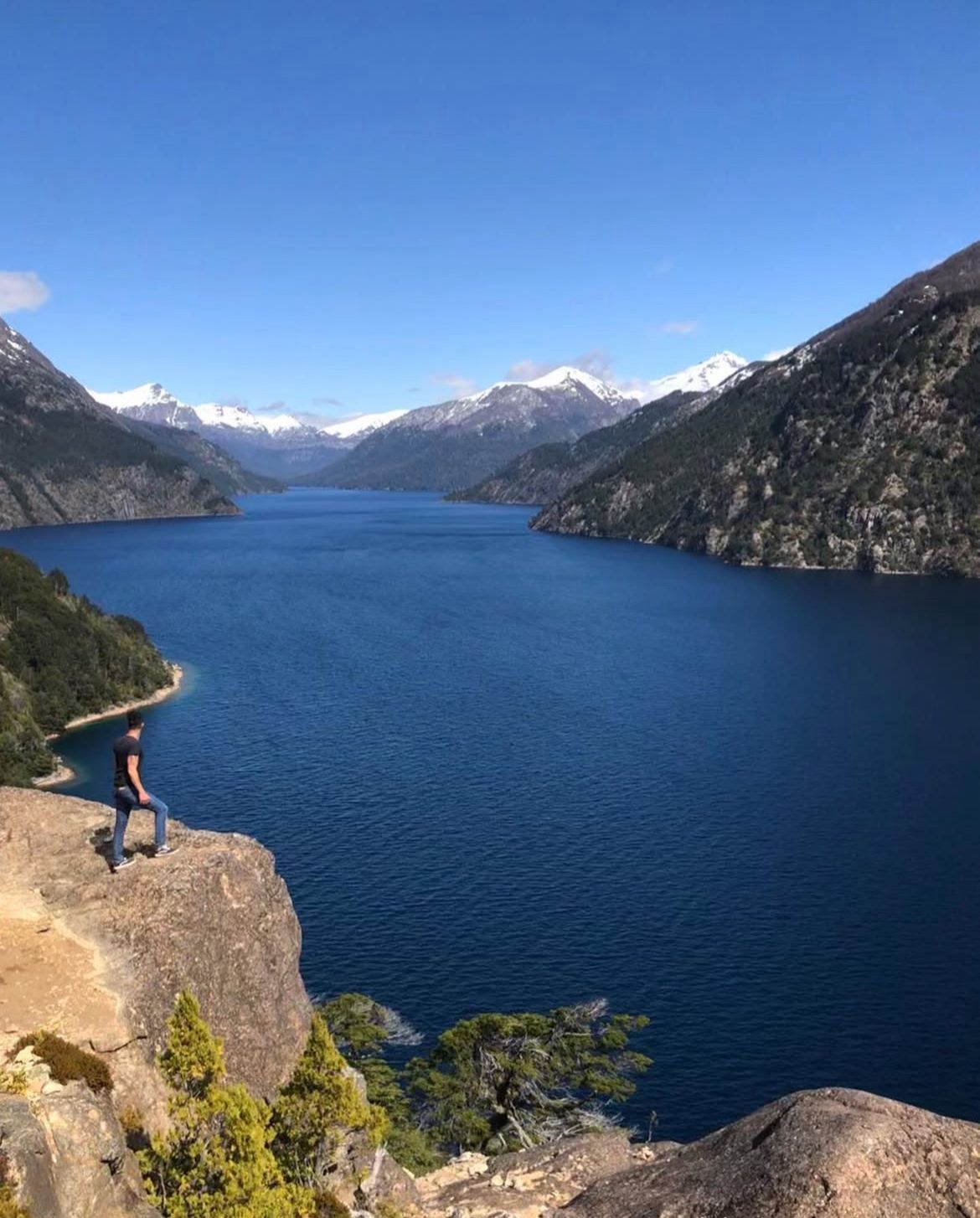
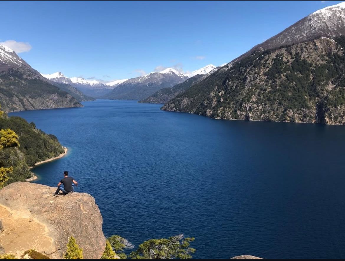
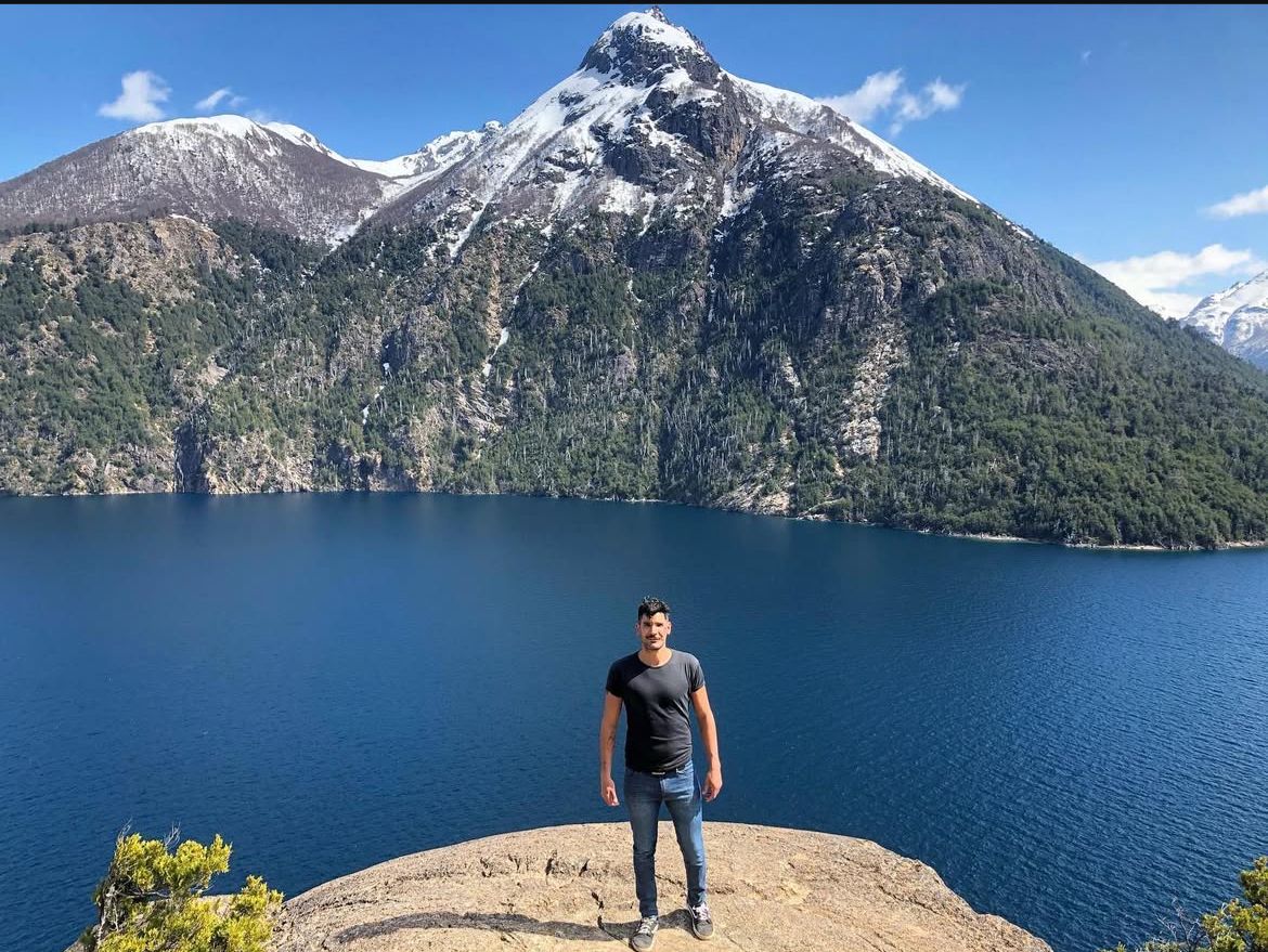
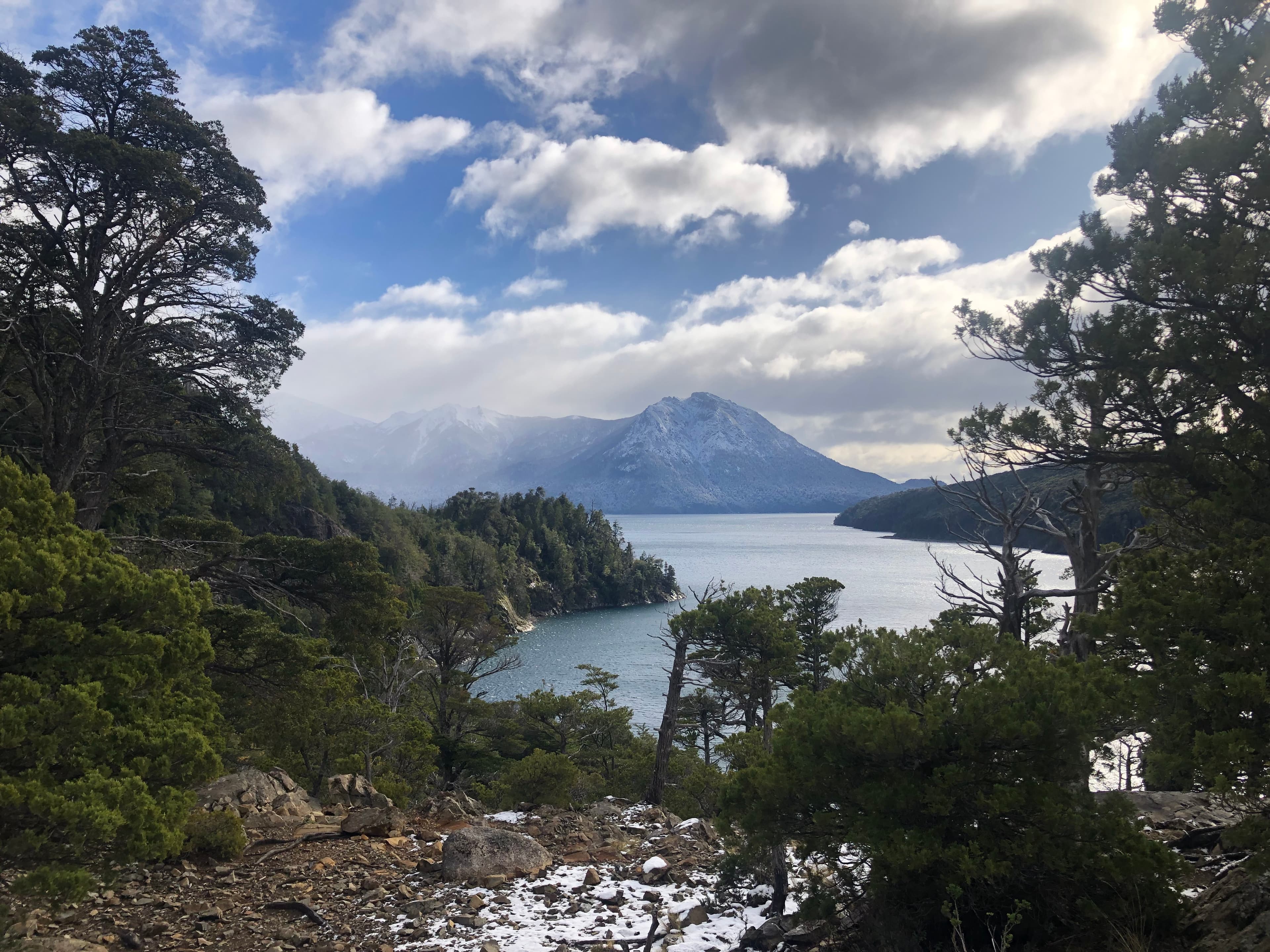
The Brazo Tristeza Viewpoint is one of the most beautiful and accessible short hikes in Bariloche. Starting from Bahía López, in less than an hour it rewards you with an impressive view over the Brazo Tristeza of Lake Nahuel Huapi, surrounded by Andean Patagonian forest. It’s an ideal hike for those looking for a mountain experience without great physical effort.
Complete guide to hiking the Brazo Tristeza Viewpoint in Bariloche
The Brazo Tristeza Viewpoint is one of the most beautiful and accessible short hikes in Bariloche. Starting from Bahía López, in less than an hour it rewards you with an impressive view over the Brazo Tristeza of Lake Nahuel Huapi, surrounded by Andean Patagonian forest. It’s an ideal hike for those looking for a mountain experience without great physical effort.

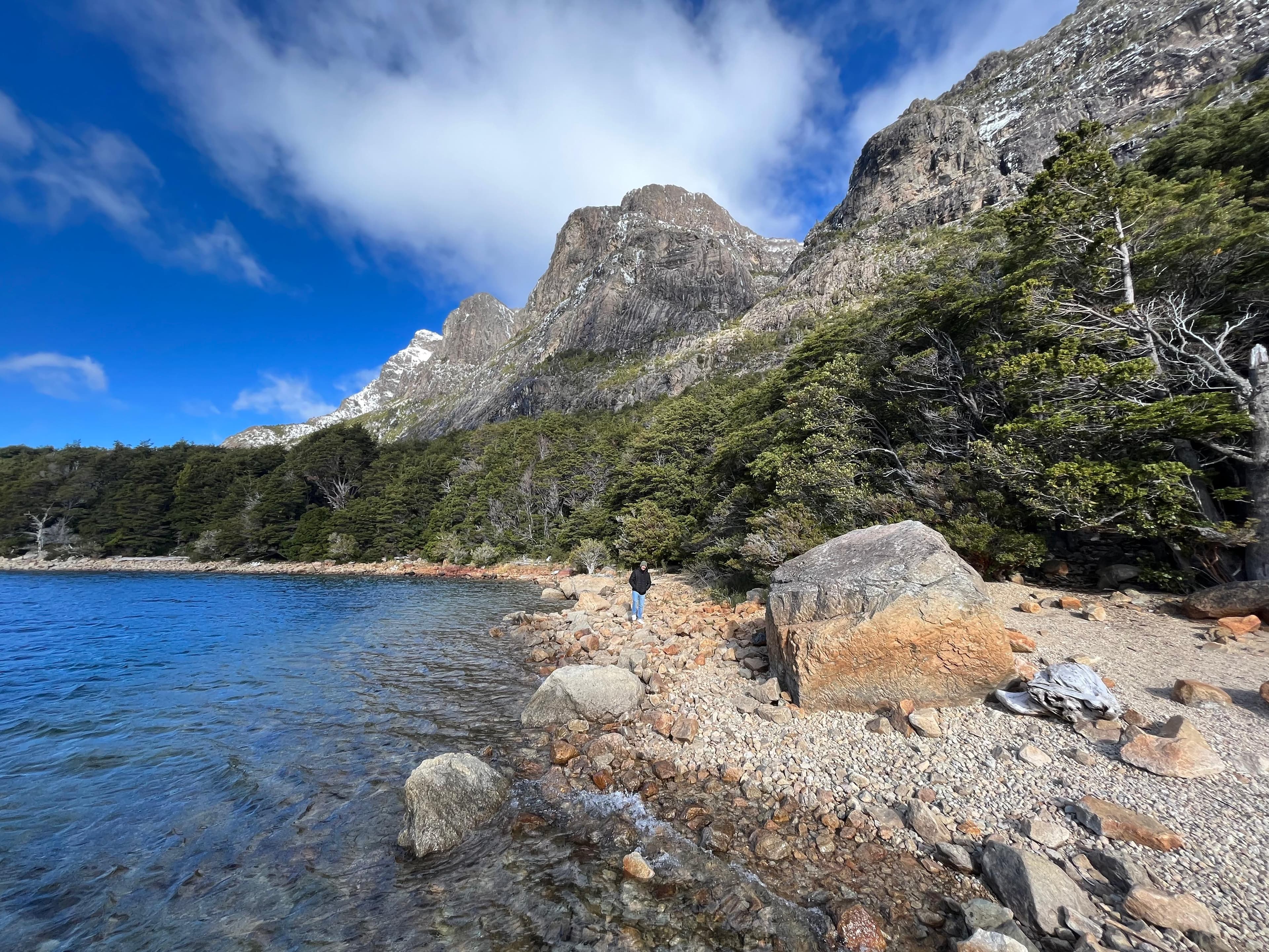
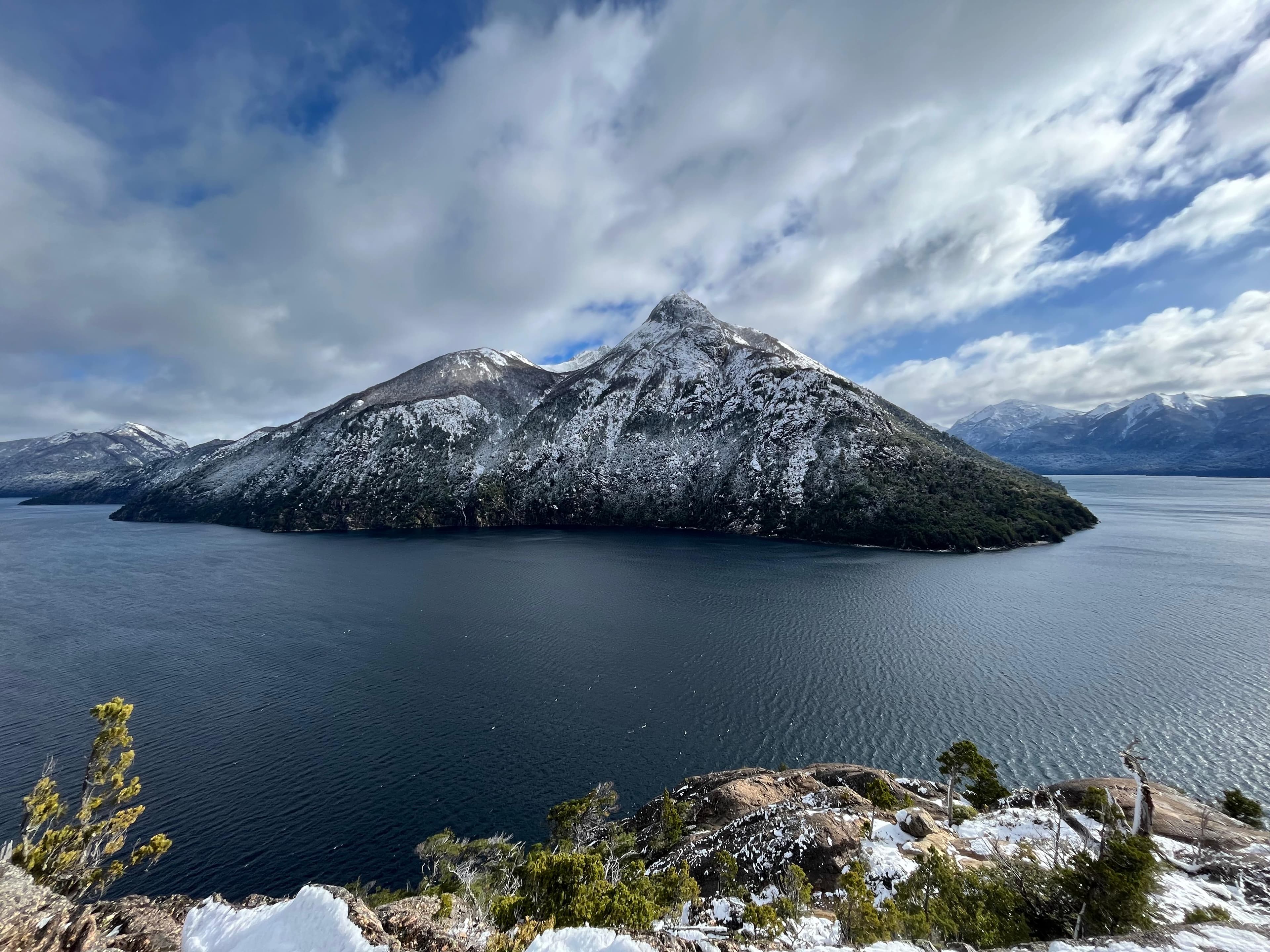
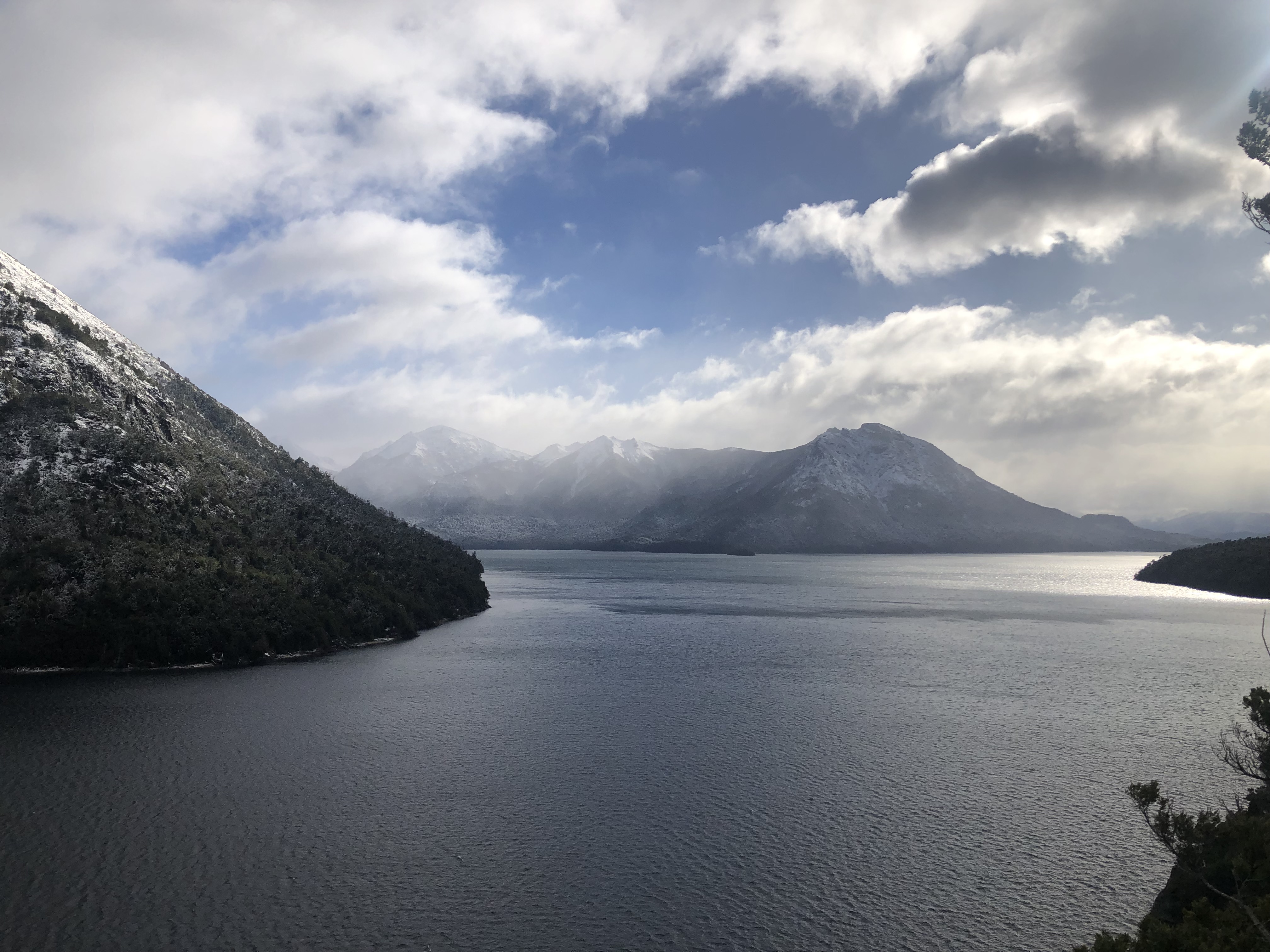
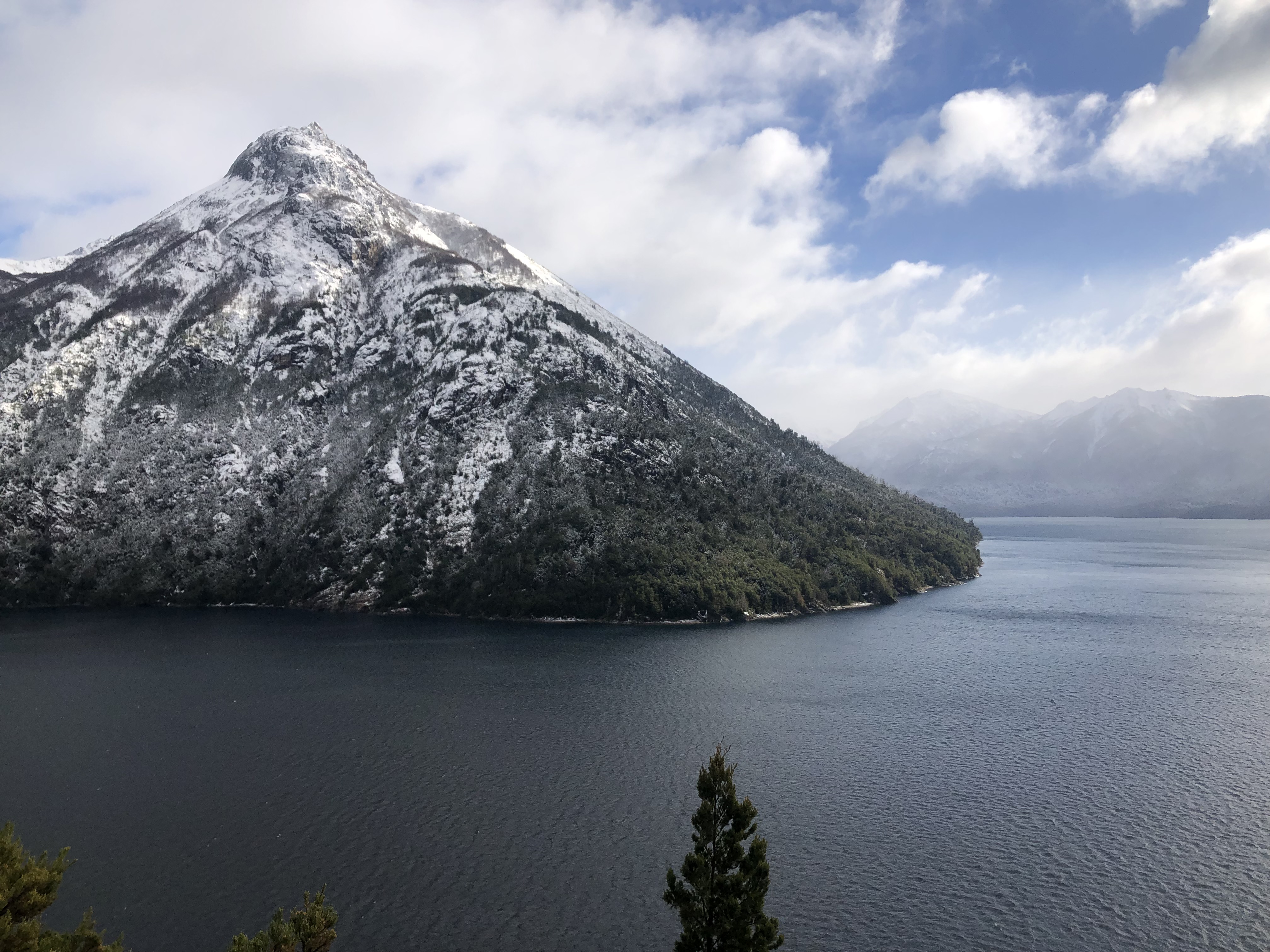
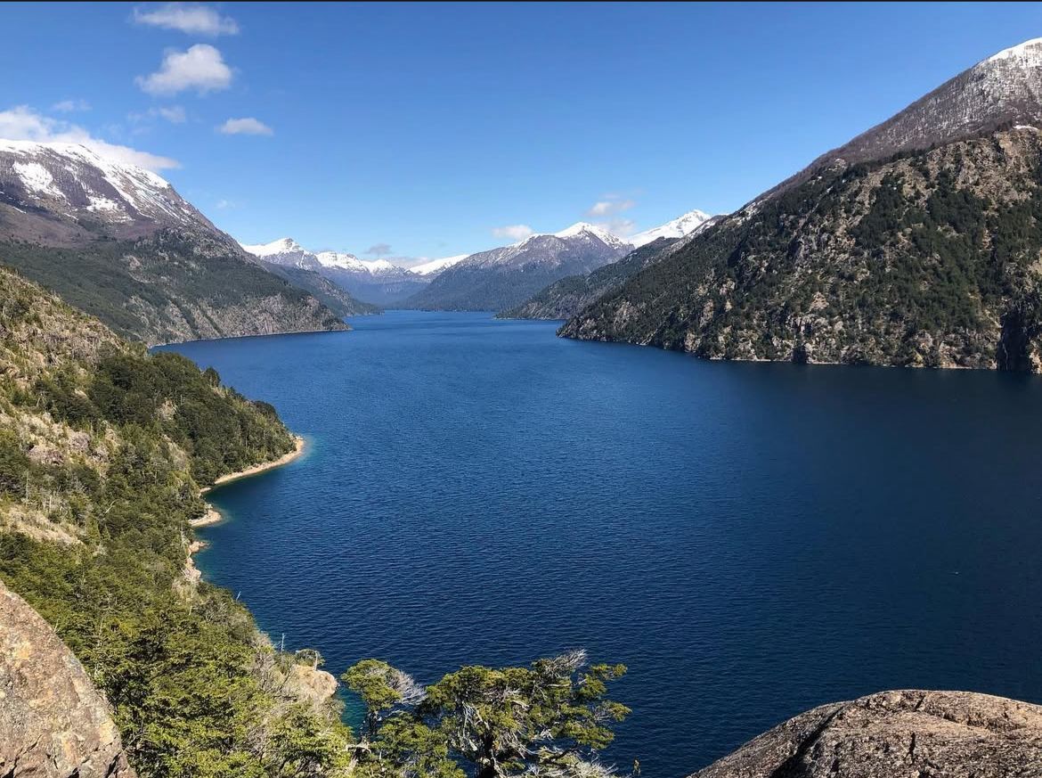
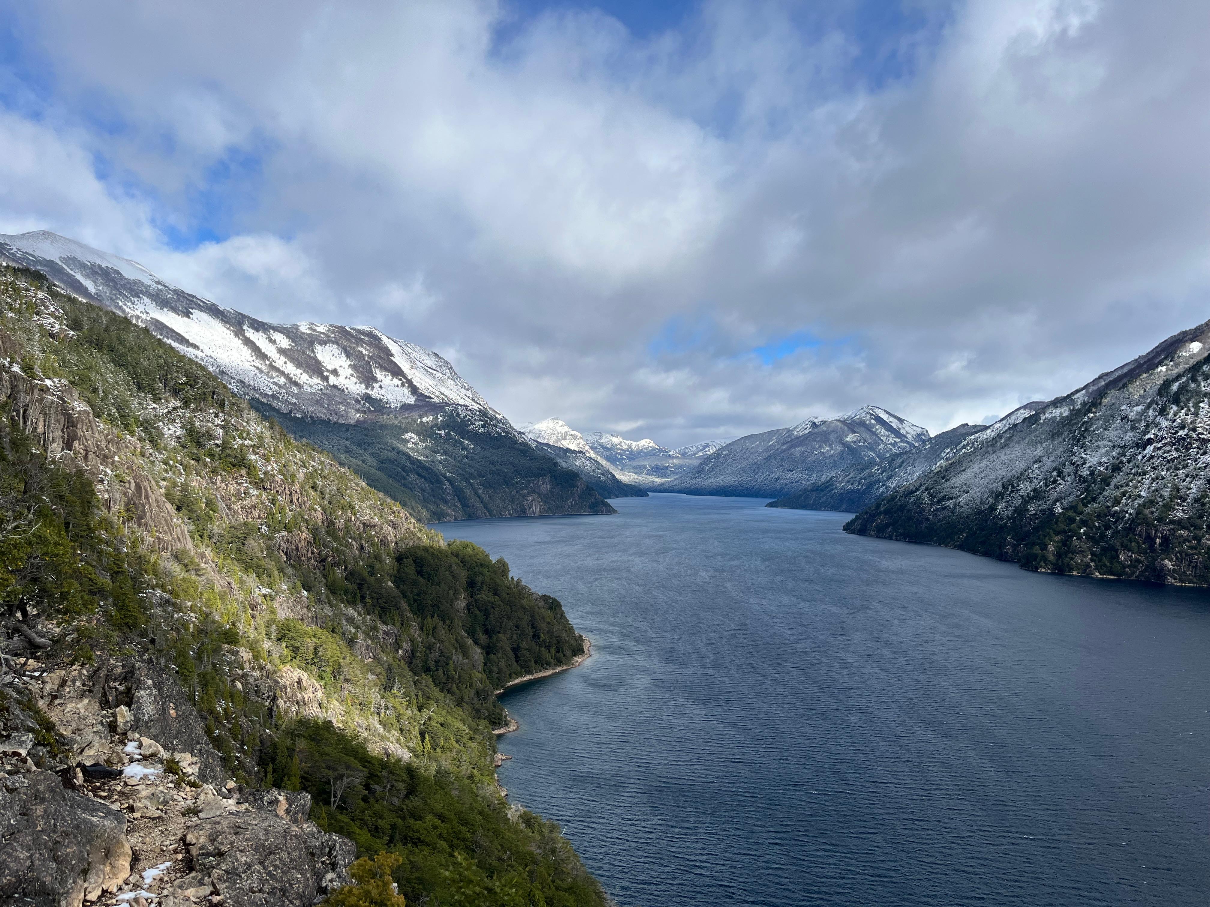
The Brazo Tristeza Viewpoint is one of our favorites. We’ve done it several times and always come back. The trail starts at Bahía López, within the Circuito Chico, and just getting there is already part of the experience. The bay itself is beautiful, but the reward comes at the end of the hike: an open view of the Brazo Tristeza of Lake Nahuel Huapi. Its name comes from a particular phenomenon that occurs during snowmelt season, when multiple waterfalls descend along the slopes, making the mountains appear to “cry.”
How to get to the Brazo Tristeza Viewpoint
The trail starts from the Bahía López parking area (km 32 of Circuito Chico).
Ways to get there:
-
Car or motorcycle: via Avenida Bustillo heading west, about 25 km to Bahía López. Free parking available.
-
Public bus: line 10 (check schedules in advance).
-
Tours or private transfers: less common, but possible when combined with Circuito Chico.
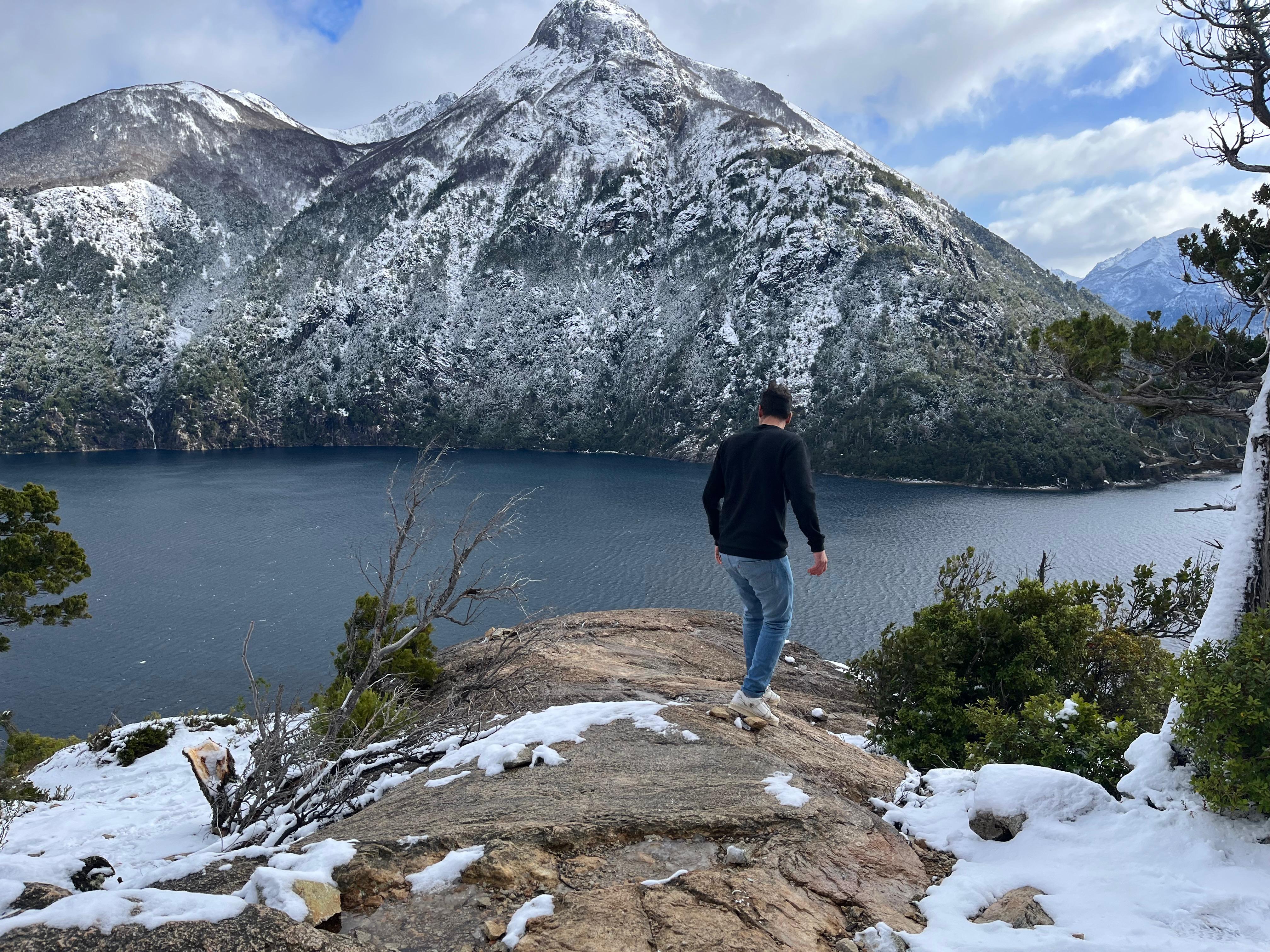
What to do in winter
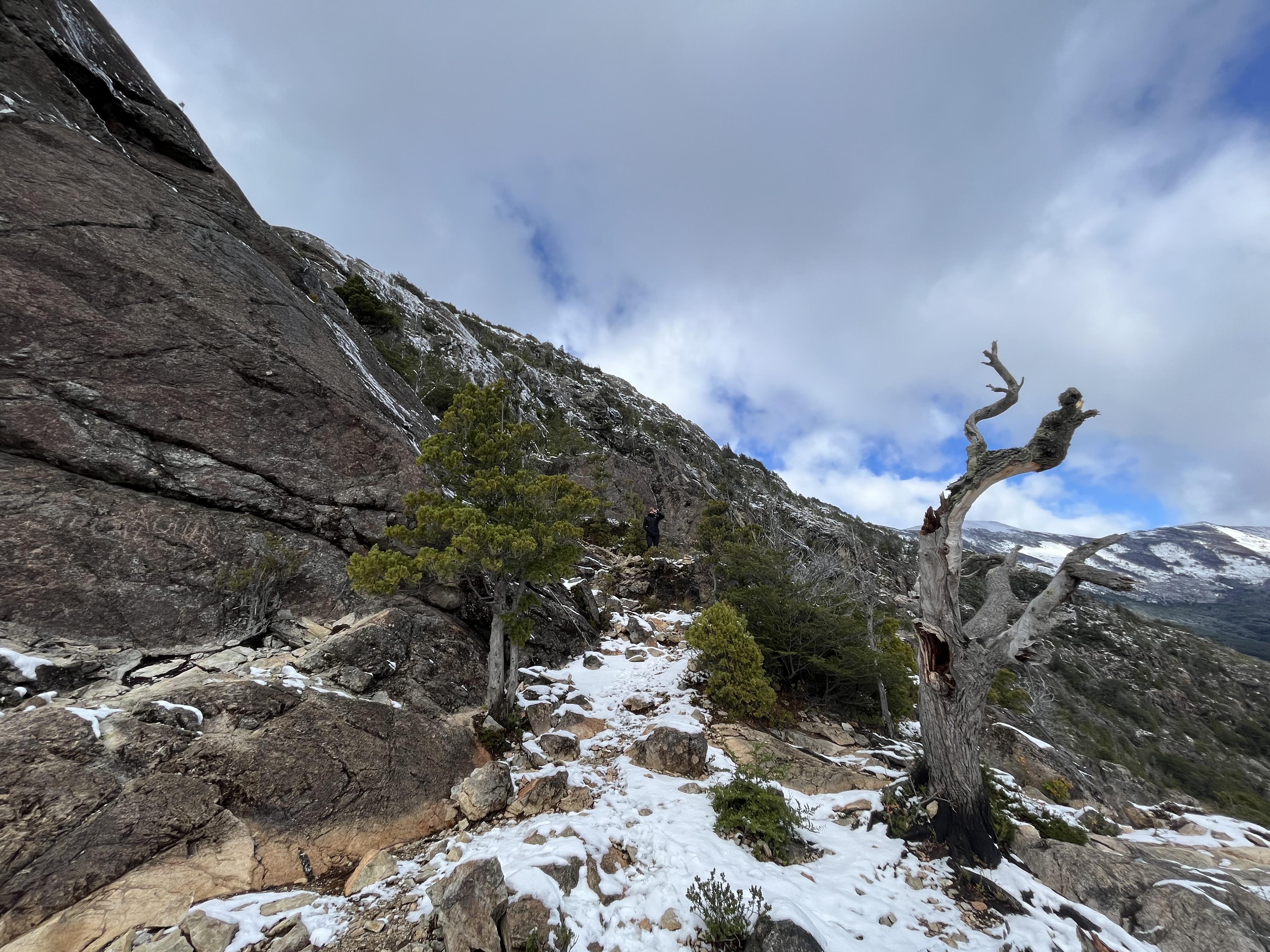
In winter, the landscape changes significantly and there may be mud, ice, or even snow.
Highlights:
-
Hiking with a winter landscape
-
Photography of snow-covered mountains
-
A quieter experience with fewer visitors
-
Observing the contrast between the lake and snowy peaks
It’s essential to check trail conditions before heading out.

What to do in summer
This is the best time to hike with greater safety and comfort.
Summer highlights:
-
Dry and stable trail
-
Long days, perfect to combine with Bahía López
-
Panoramic lake photography
-
Relaxing by the shore after the hike
It can also be combined on the same day with Circuito Chico or Cerro Campanario.

Trailhead: services and surroundings
At Bahía López you’ll find:
-
Parking area
-
Clearly marked trail access
-
Beach and lakeshore to relax
There are no shelters or services at the viewpoint, so it’s important to bring everything you need.
Best time to visit
-
Spring and summer: dry trail and ideal conditions.
-
Autumn: spectacular forest colors.
-
Winter: possible mud or snow, check conditions beforehand.
It can be done year-round, but trail conditions vary depending on the season.

Trek details
The route is short but very rewarding:
-
Difficulty: easy to moderate
-
Total time: approximately 1.5 hours (round trip)
-
Distance: 2 km
-
Elevation gain: 95 meters
The trail is well marked and has no technical sections.
High season and crowds
In summer and on weekends, there may be more visitors.
-
It’s best to go early in the morning.
-
A great option if you’re looking for a short hike without large crowds.
-
In low season, it’s usually very quiet.

Useful tips
-
Wear comfortable hiking shoes or boots.
-
Bring enough water.
-
Use sunscreen and bring a light jacket.
-
Stay on the marked trail.
-
Keep a safe distance from cliffs and supervise children.
-
Take all your trash with you.
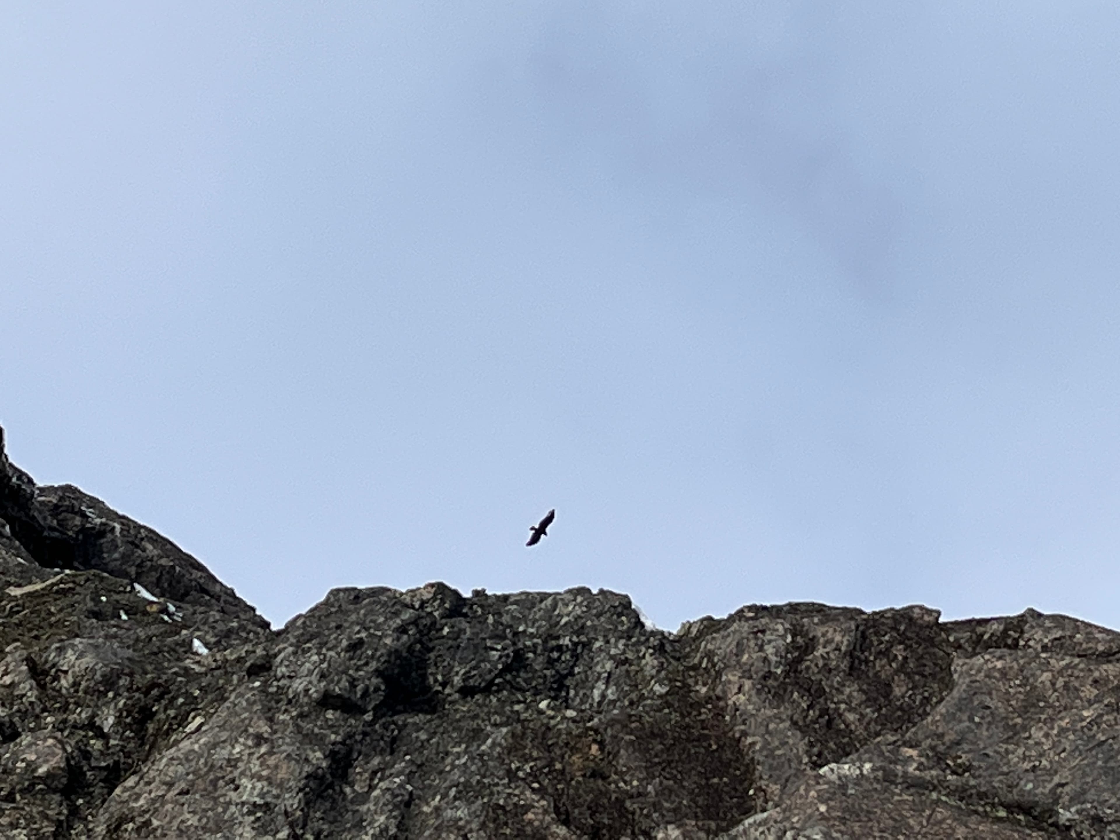
If you look up, you might spot the Andean condor flying overhead.
You may also be interested in
The trail starts from the Bahía López parking area (km 32 of Circuito Chico).
Ways to get there:
-
Car or motorcycle: via Avenida Bustillo heading west, about 25 km to Bahía López. Free parking available.
-
Public bus: line 10 (check schedules in advance).
-
Tours or private transfers: less common, but possible when combined with Circuito Chico.
PUBLICIDAD
Travel with Data: Get your Saily eSIM
- ✓Internet in seconds upon landing
- ✓Flexible plans in 180+ countries
- ✓Easy setup directly via the App
In winter, the landscape changes significantly and there may be mud, ice, or even snow.
Highlights:
-
Hiking with a winter landscape
-
Photography of snow-covered mountains
-
A quieter experience with fewer visitors
-
Observing the contrast between the lake and snowy peaks
It’s essential to check trail conditions before heading out.
This is the best time to hike with greater safety and comfort.
Summer highlights:
-
Dry and stable trail
-
Long days, perfect to combine with Bahía López
-
Panoramic lake photography
-
Relaxing by the shore after the hike
It can also be combined on the same day with Circuito Chico or Cerro Campanario.
At Bahía López you’ll find:
-
Parking area
-
Clearly marked trail access
-
Beach and lakeshore to relax
There are no shelters or services at the viewpoint, so it’s important to bring everything you need.
-
Spring and summer: dry trail and ideal conditions.
-
Autumn: spectacular forest colors.
-
Winter: possible mud or snow, check conditions beforehand.
It can be done year-round, but trail conditions vary depending on the season.
The route is short but very rewarding:
-
Difficulty: easy to moderate
-
Total time: approximately 1.5 hours (round trip)
-
Distance: 2 km
-
Elevation gain: 95 meters
The trail is well marked and has no technical sections.
In summer and on weekends, there may be more visitors.
-
It’s best to go early in the morning.
-
A great option if you’re looking for a short hike without large crowds.
-
In low season, it’s usually very quiet.
-
Wear comfortable hiking shoes or boots.
-
Bring enough water.
-
Use sunscreen and bring a light jacket.
-
Stay on the marked trail.
-
Keep a safe distance from cliffs and supervise children.
-
Take all your trash with you.
If you look up, you might spot the Andean condor flying overhead.
PUBLICIDAD
Galery

PUBLICIDAD
Get Your International Travel Insurance Quote
- ✓International medical insurance
- ✓24/7 immediate assistance in your language
- ✓Ideal for trekking & adventure


Preferences
Language
Color
Text
Width