
Refugio Lopez in Bariloche: trekking, difficulty, how to get there and tips

Refugio Lopez is one of the classic treks in Bariloche, ideal both for those looking for a challenging day hike and for those who want to continue toward nearby summits.
Refugio Lopez in Bariloche: trekking, difficulty, how to get there and tips
Refugio Lopez is one of the classic treks in Bariloche, ideal both for those looking for a challenging day hike and for those who want to continue toward nearby summits.
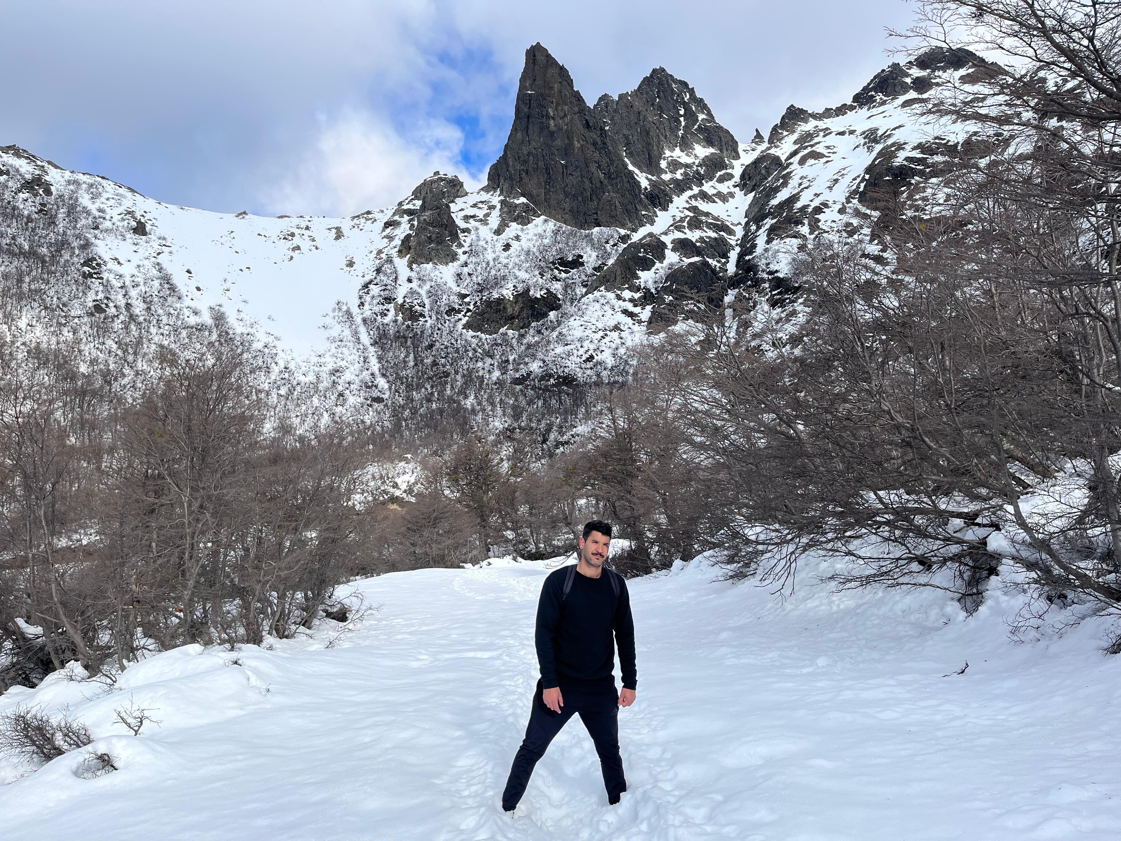
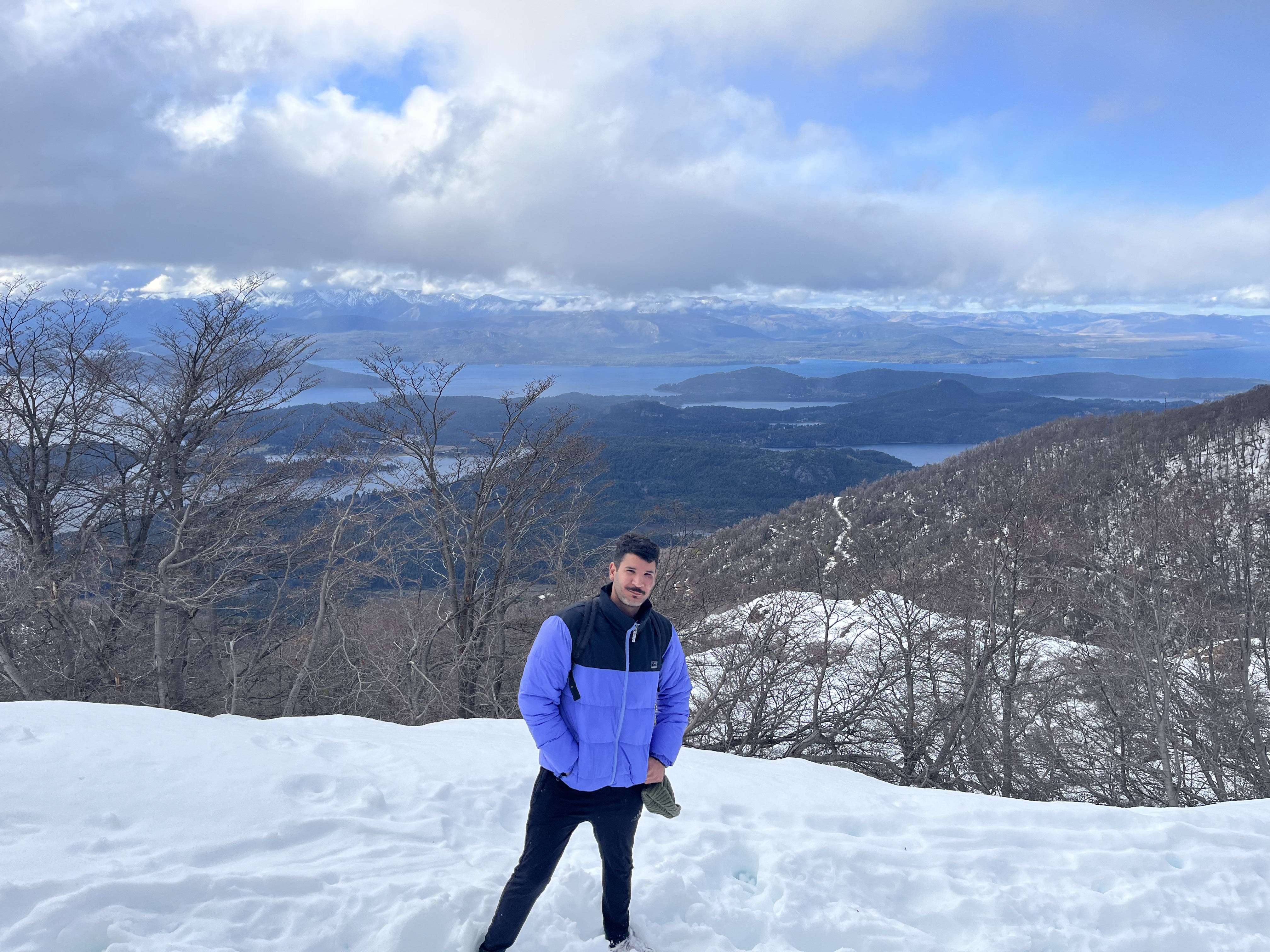
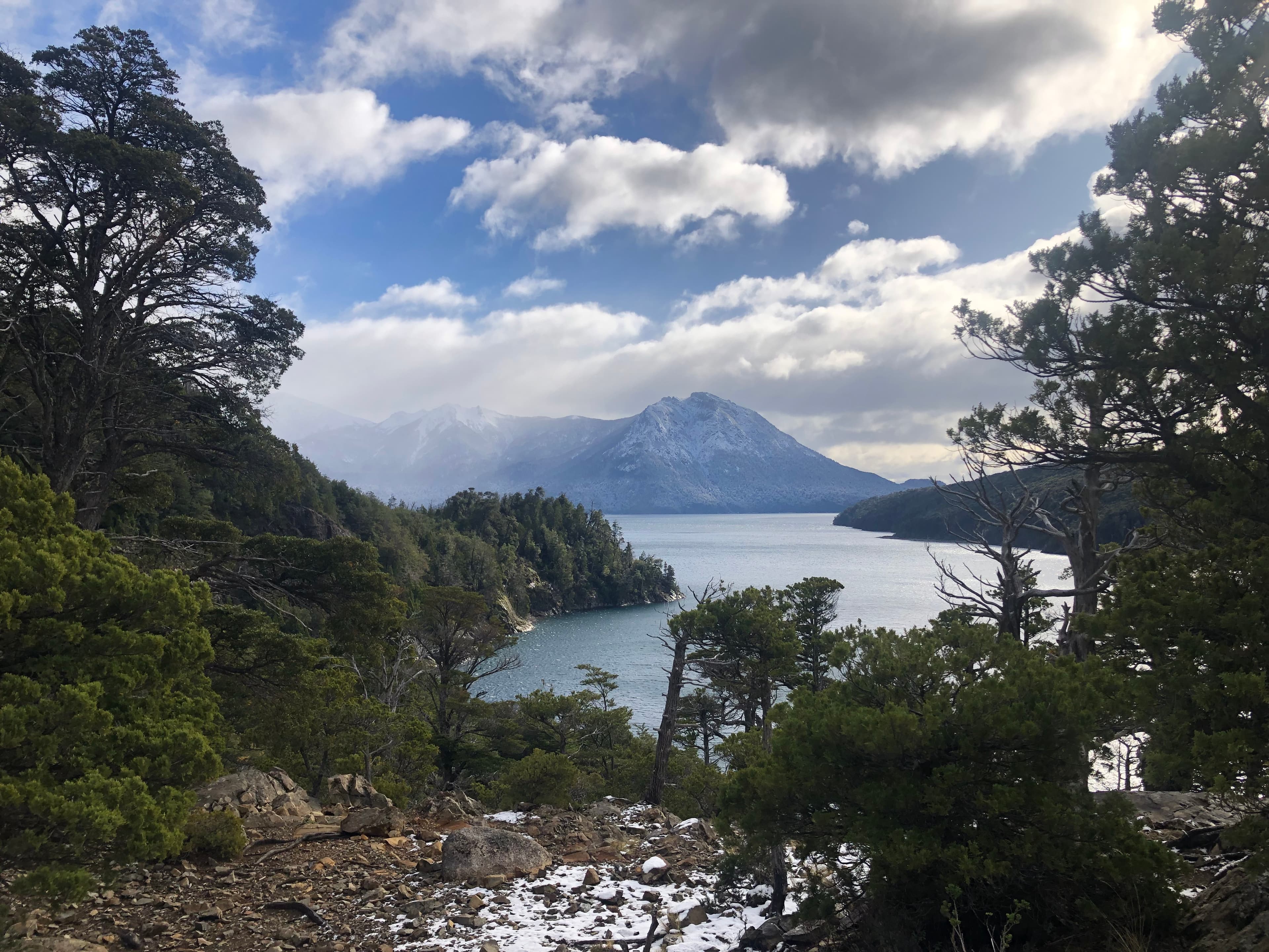
The route combines Andean forest, constant elevation gain, and panoramic views that reward every step. It is a demanding trek but accessible for those in good physical condition who want to experience a true mountain adventure in Nahuel Huapi National Park.
Where is it and how to get to the trailhead?
The trail starts at km 22.5 of Circuito Chico, next to Arroyo Lopez, on the paved road.
-
By car - Drive along Avenida Bustillo to the roundabout at km 18. Take Circuito Chico to the right and continue until the Arroyo Lopez sign (approx. km 22.5), where there is space to park.
-
Public transport - Take bus line 10 toward Colonia Suiza and get off at the trailhead stop.
The trail begins next to Arroyo Lopez, beside a kiosk/cabin visible from the road.
Distance, elevation gain and duration
The hike to the refuge is popular because it does not require technical skills, but it does require physical fitness:
-
Approximate distance: 6 km uphill from the start to the refuge.
-
Elevation gain: between 800 and 1,260 m of accumulated ascent.
-
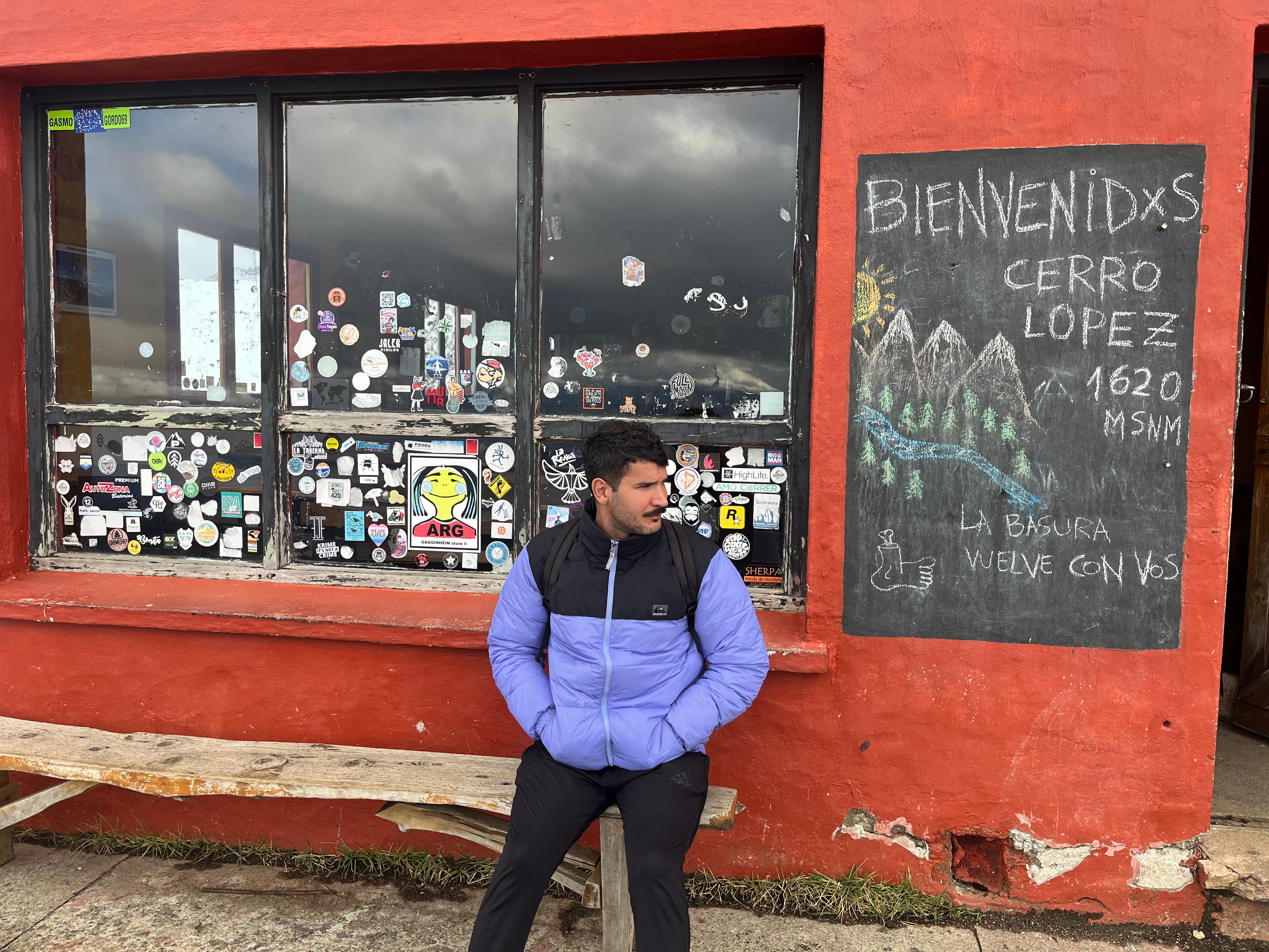
Refuge altitude: 1,620 m above sea level.
-
Estimated duration: between 3 and 4 hours to ascend (depending on pace and breaks).
The trail is signposted and well marked, although markings can be sparse at the beginning.
Difficulty
-
Trek to Refugio Lopez: moderate difficulty in summer (constant incline and sometimes rocky terrain).
-
In winter / snow: much more difficult; requires experience, proper equipment (crampons, ice axes) and extreme caution.
The trail ends by crossing Arroyo Lopez, which can be challenging if water levels are high in spring or after heavy rain.
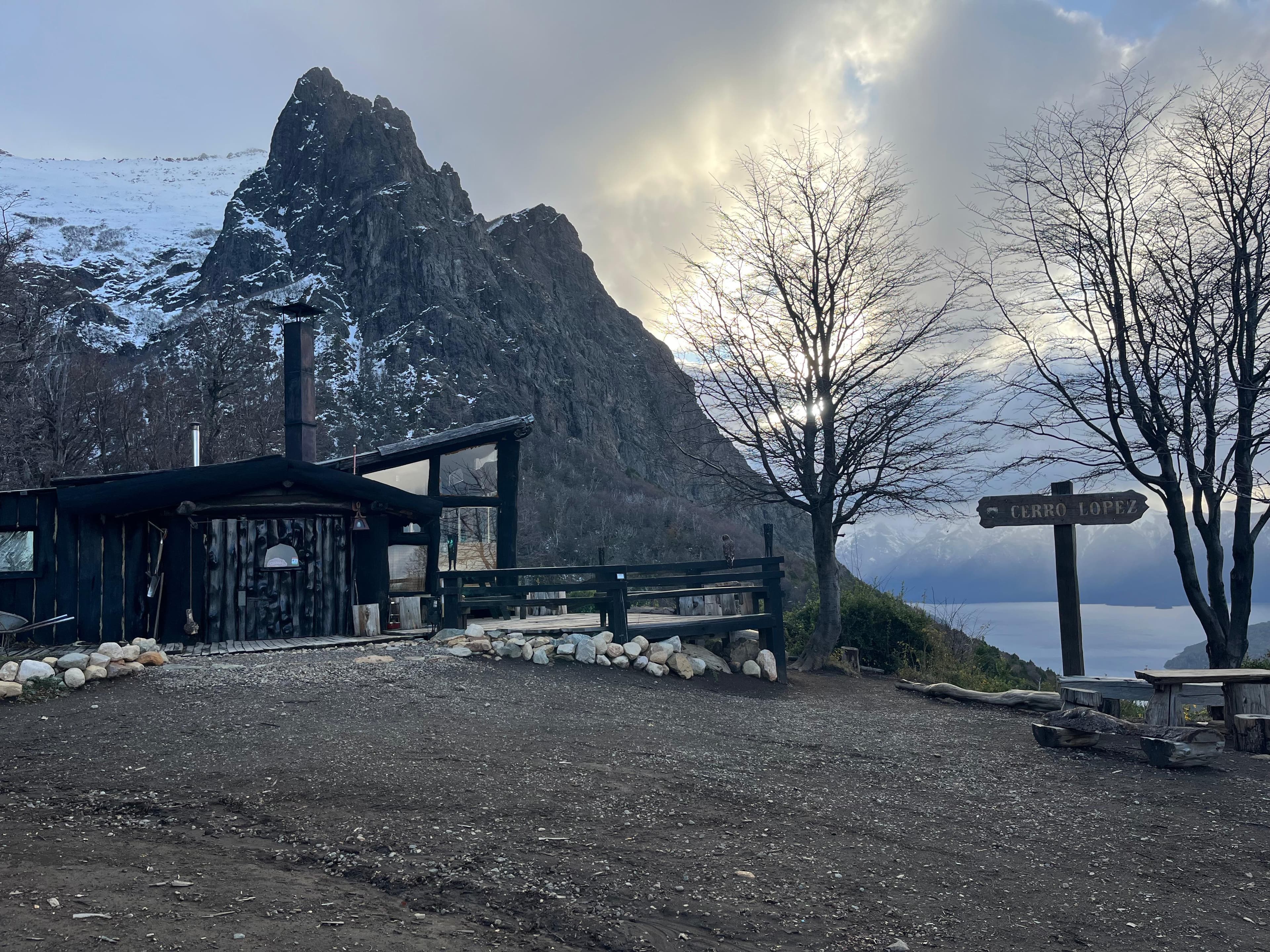
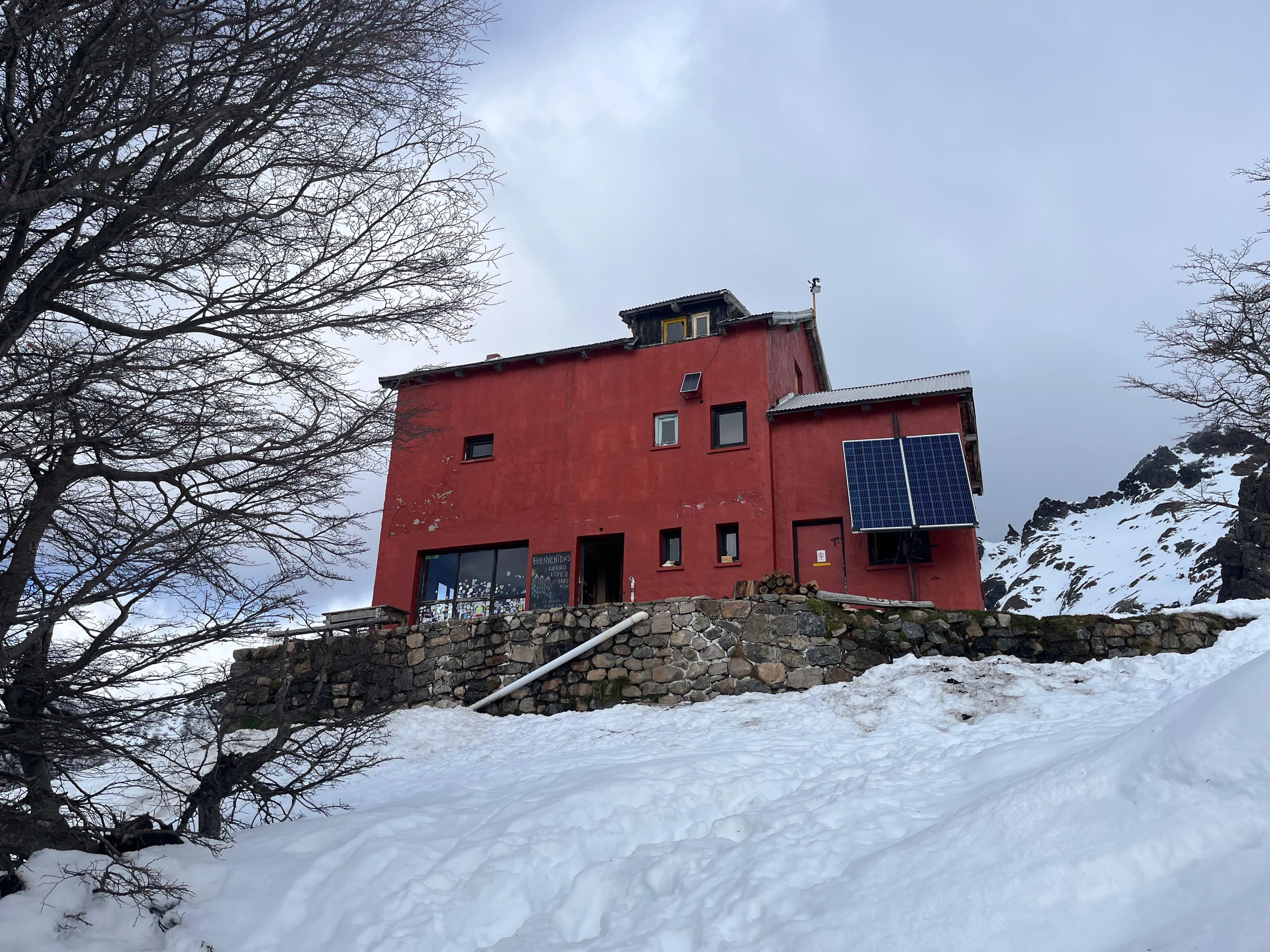
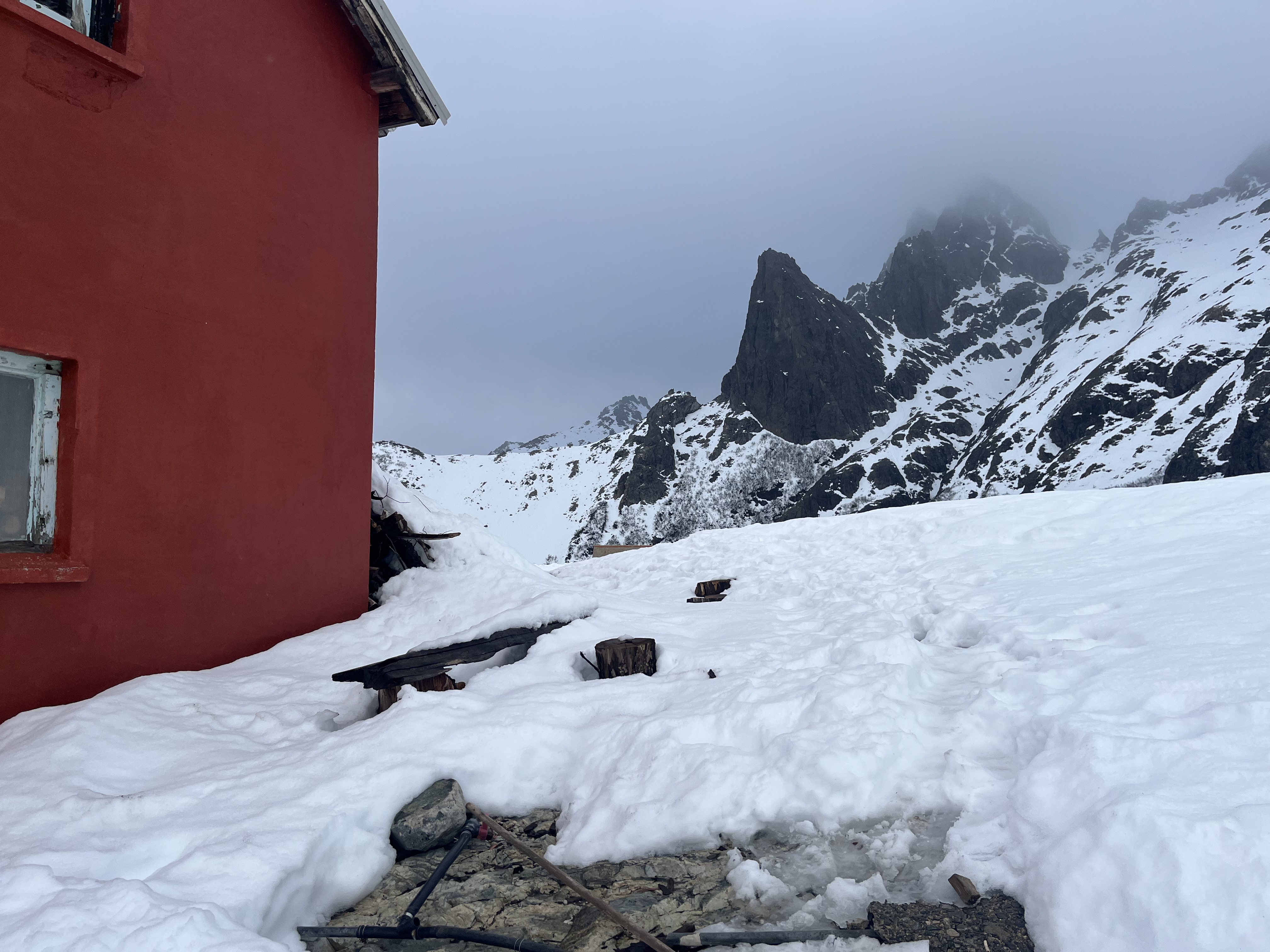
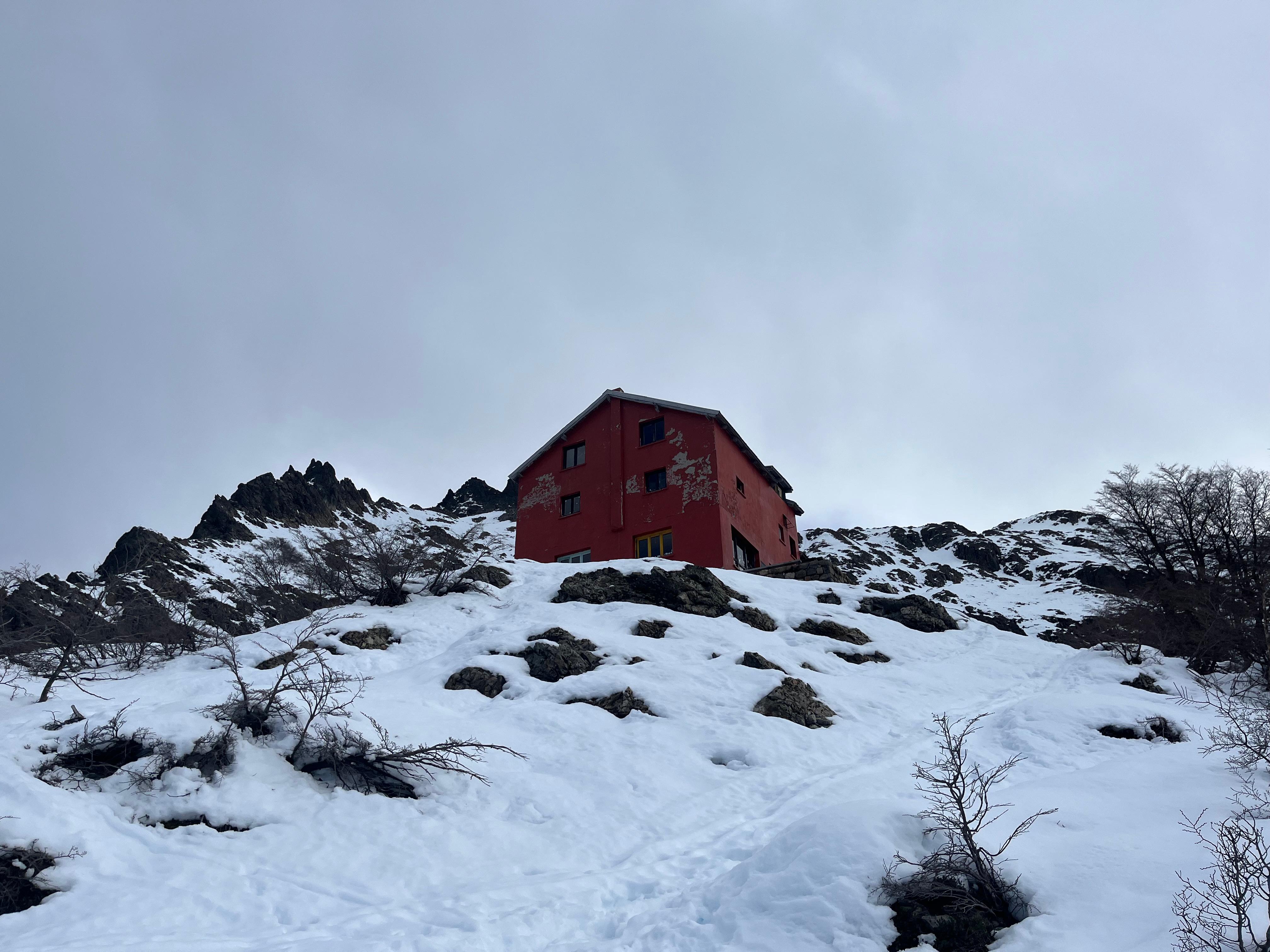
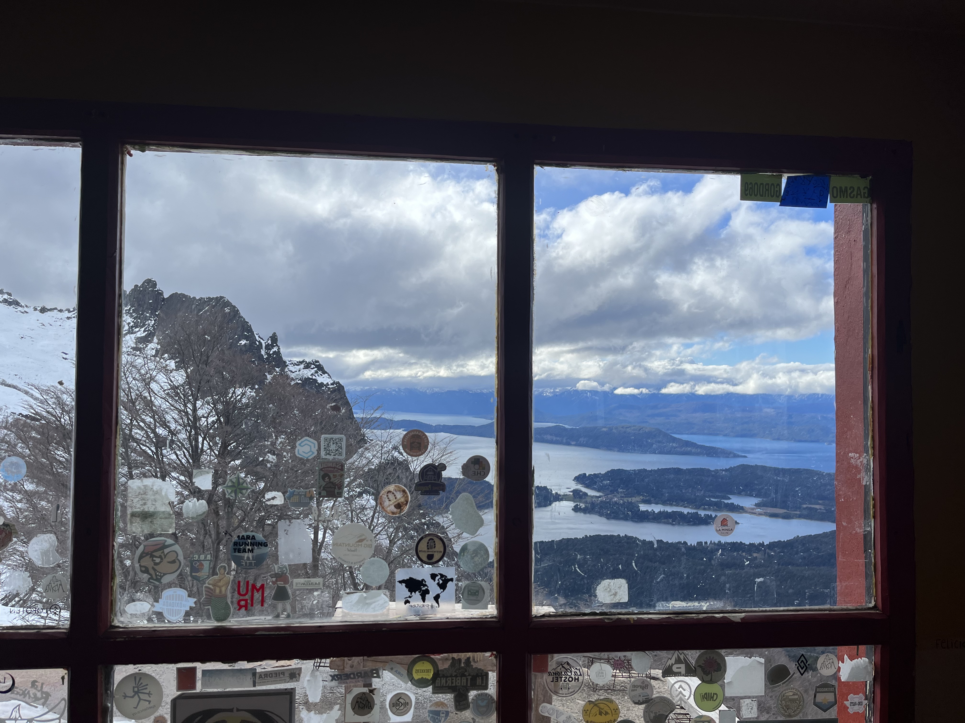
Refugio Lopez
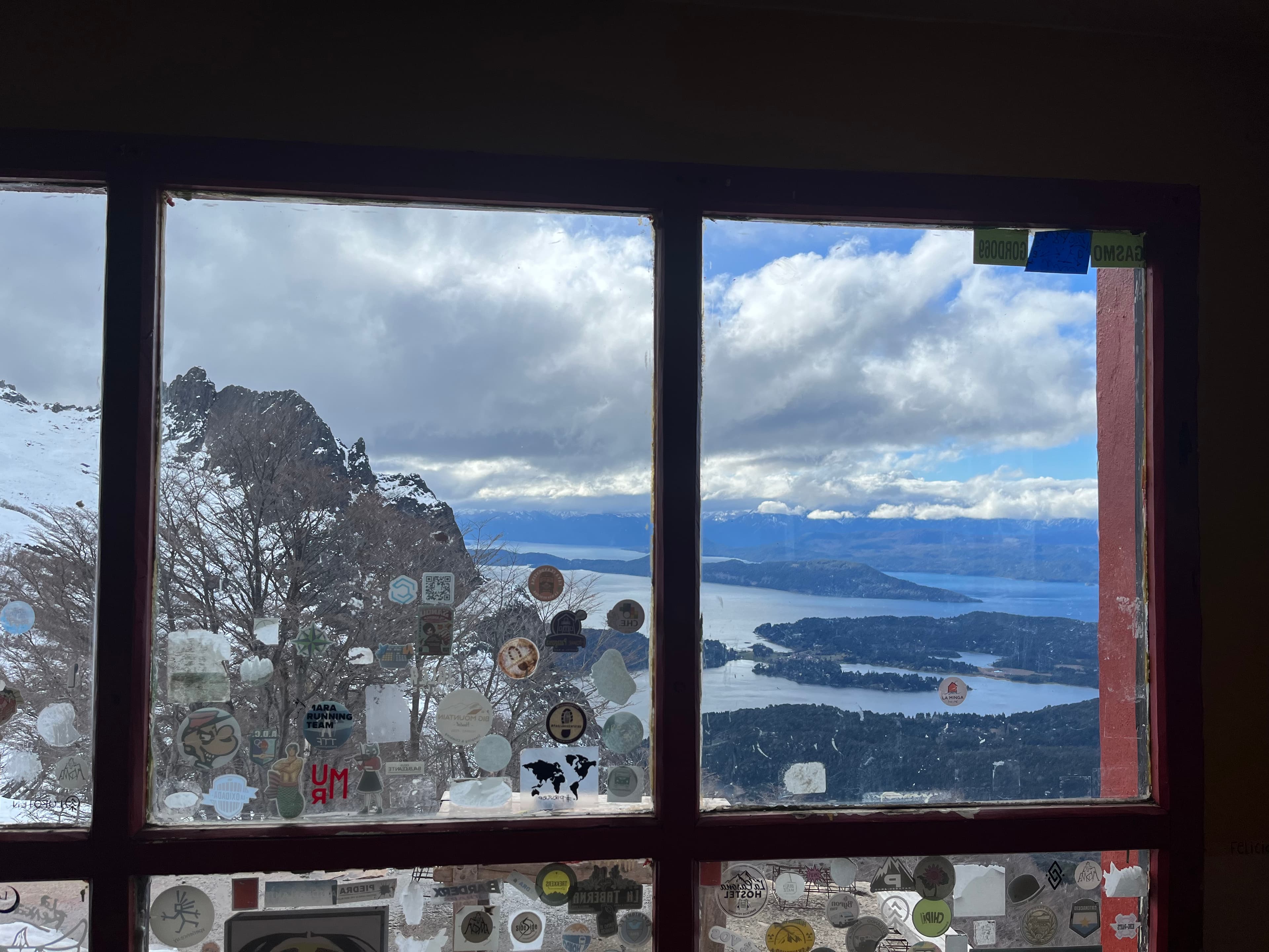
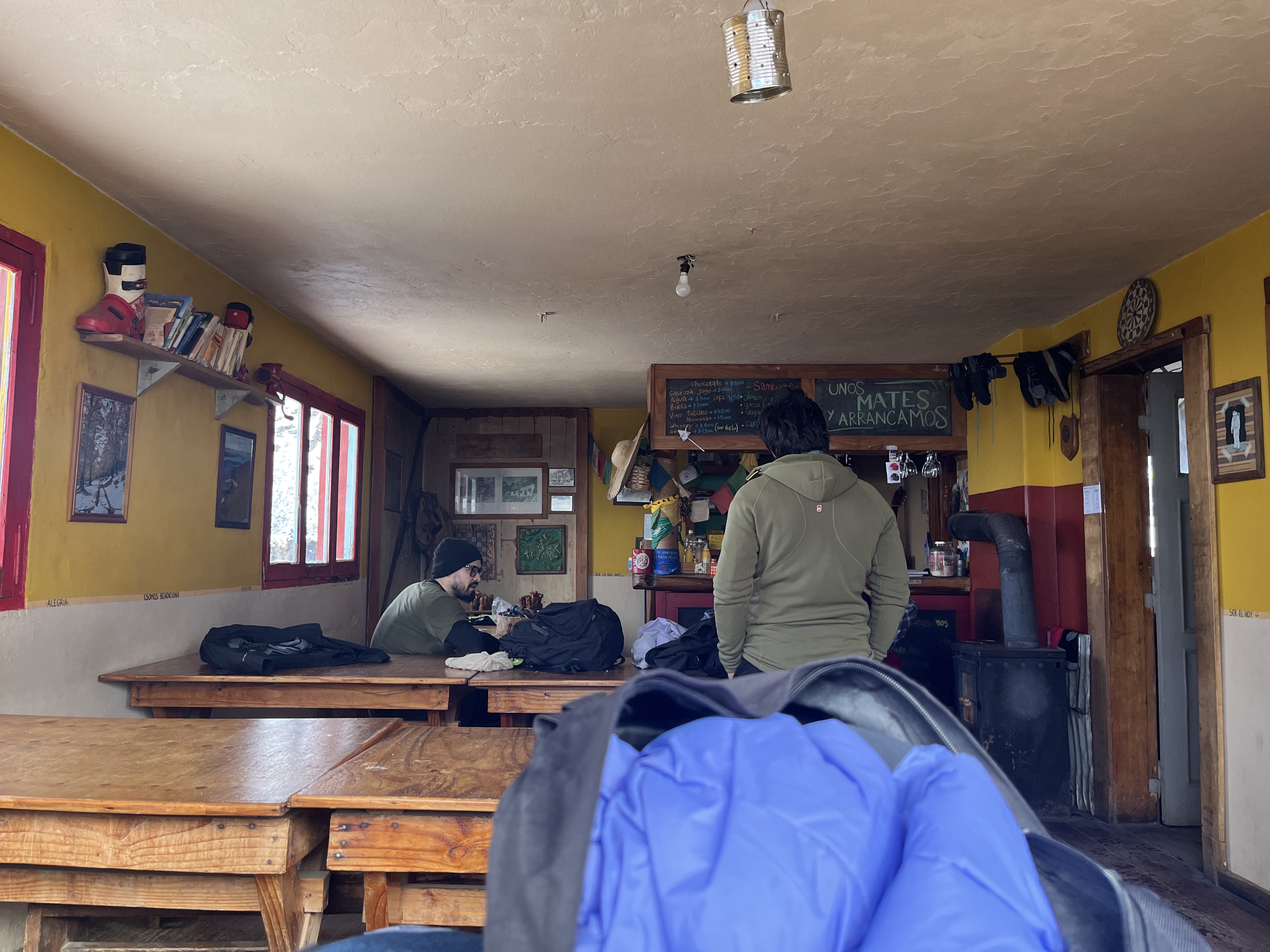
Refugio Lopez is a private mountain hut, one of the largest and most comfortable in Bariloche, with capacity for around 100 people and a large dining area.
-
Altitude: 1,620 m above sea level.
-
Services: dining room, rooms, bathrooms with running water (depending on season).
The refuge may close in winter. The trail usually remains open, but the refuge may not offer services during the coldest months.
Overnight stay and reservations
Can you notify or book in advance?
It is recommended to contact the refuge directly to check availability and prices if you plan to stay overnight.
During high season (summer – spring) it usually fills up quickly, so booking in advance is recommended.

What to do around the refuge
Once at the top, there are several additional excursions:
-
La Hoya – approximately 30 minutes further from the refuge. There is usually snow even in summer.
-
Pico Turista – about 1 hour from the refuge, with excellent panoramic views.
You can also continue toward Laguna Negra or connect with other refuges on longer multi-day routes.
Rules and precautions
-
Fire and campfires – It is not allowed to light fires in the National Park or along the trail.
-
Registration and safety – In some cases it is mandatory to complete a trekking registration before starting, especially if planning long routes.
-
Exposed sections and cliffs – There are areas with steep slopes and drop-offs, especially near the end.
-
Stream crossing – In the final meters before reaching the refuge, you must cross Arroyo Lopez, which can increase in flow during snowmelt season.
-
Always inform someone if you are going alone or in a group.
-
Water and gear – Bring at least 1.5–2 liters of water per person. Proper footwear, trekking poles, and sun protection are essential.
-
Weather and snow – Weather changes quickly in the mountains. Check the forecast before heading out. In winter, snow may cover much of the trail.
Best time to go
-
Spring to autumn (October – April): more stable conditions and the refuge is usually open.
-
Winter (May – September): more snow, higher difficulty, and possible refuge closure.
Our experience
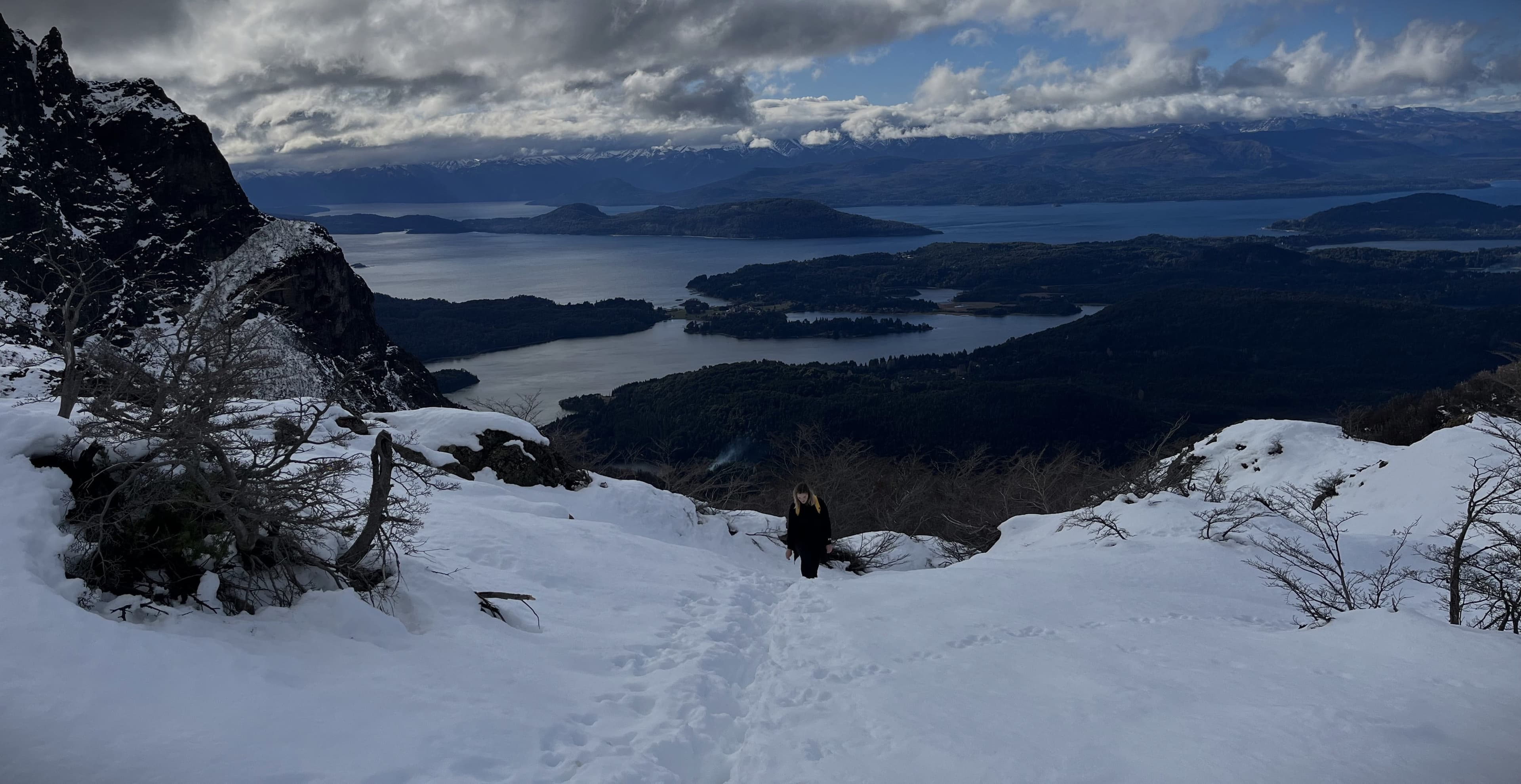
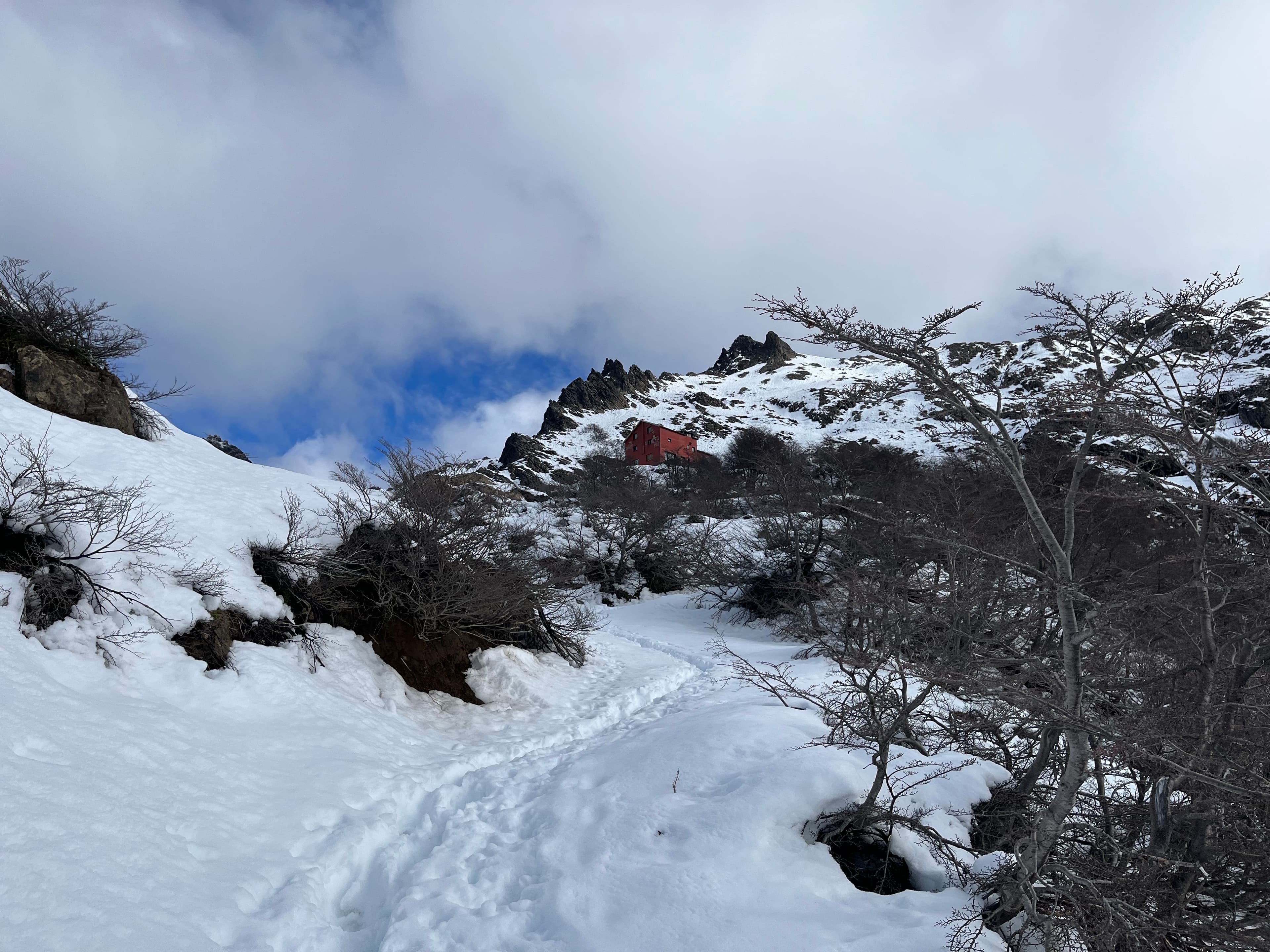
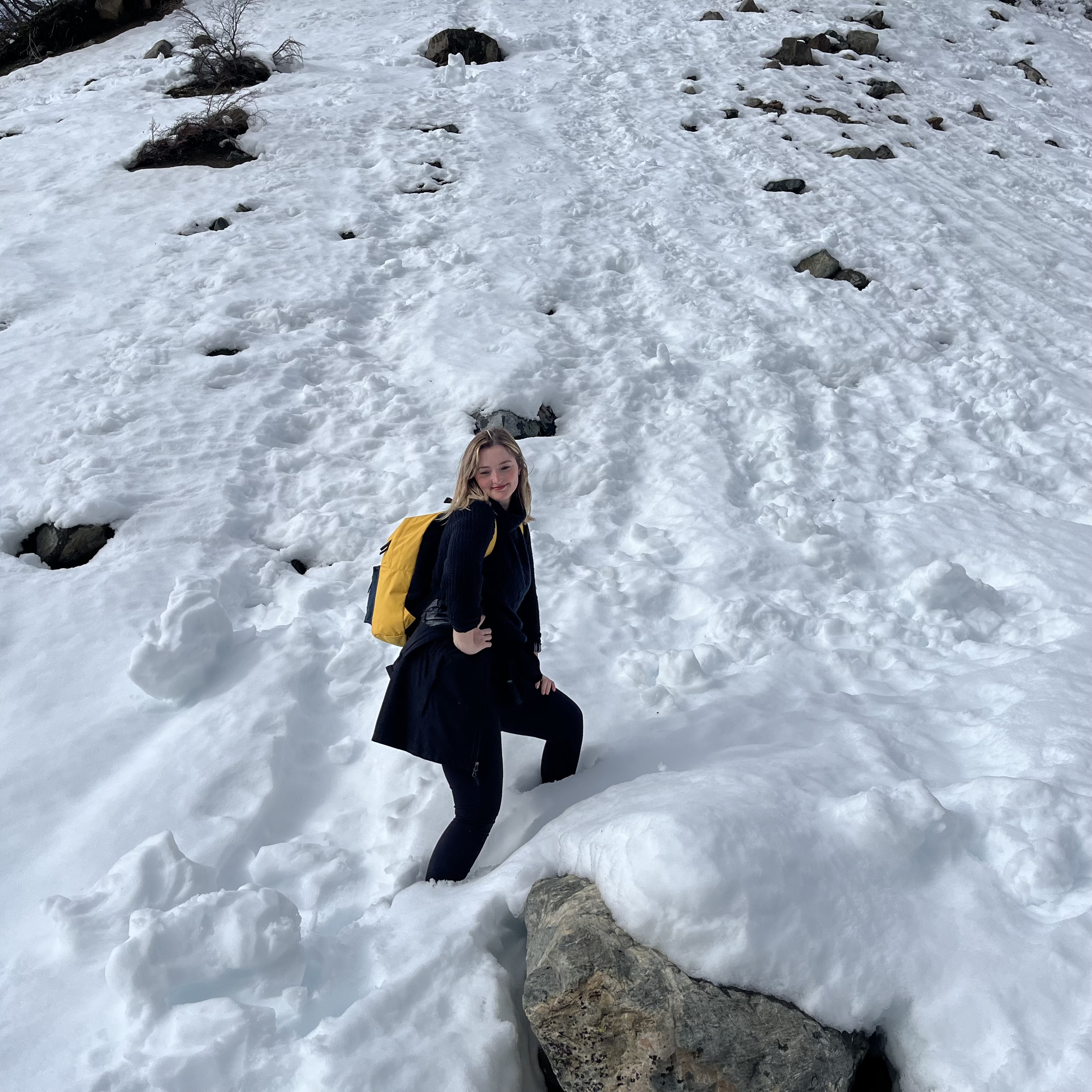
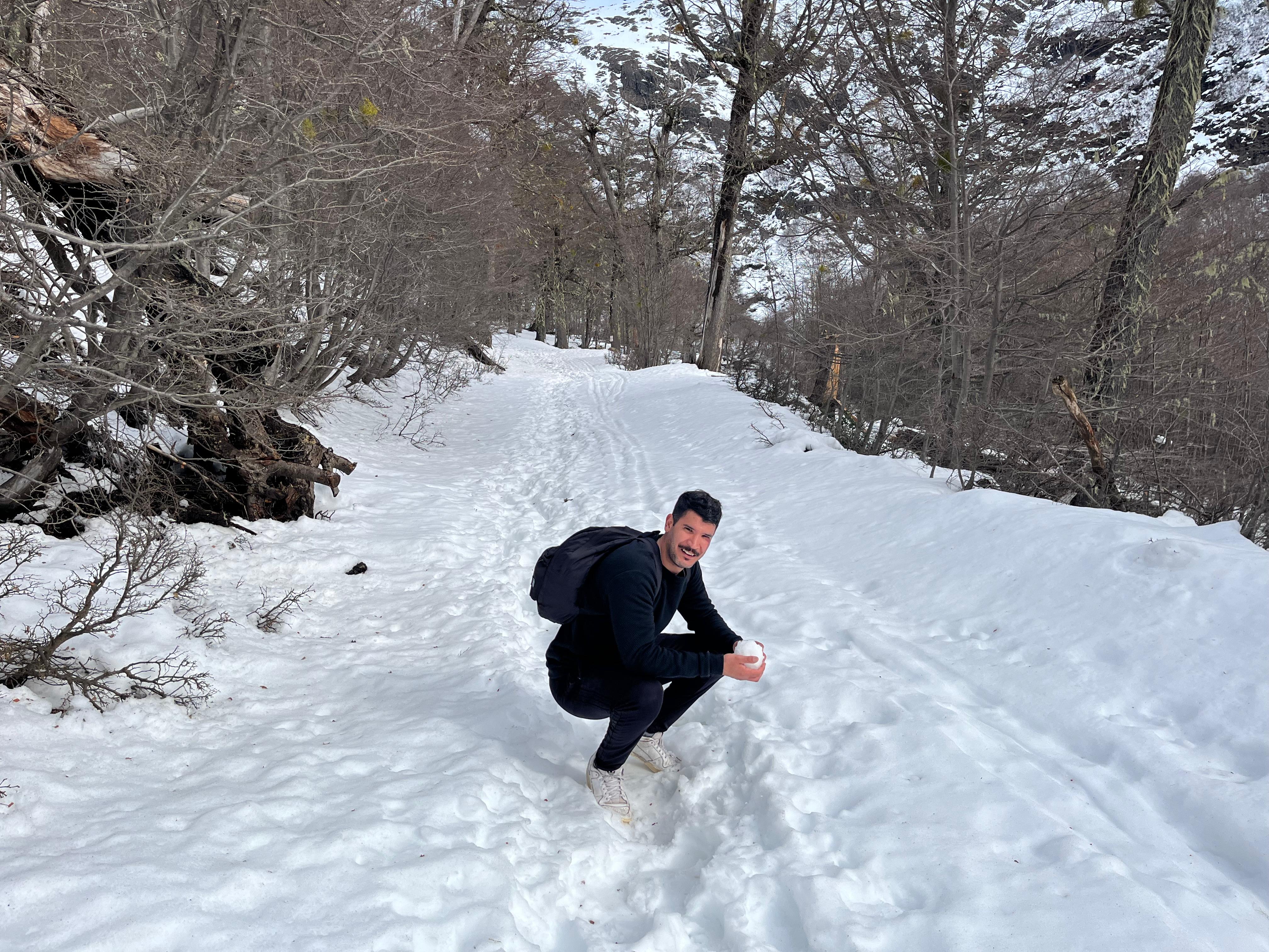
The idea of going to Refugio Lopez came out of nowhere. No plan, little information, and completely spontaneous, we decided to go on a very snowy winter day. We didn’t know that beyond a certain point the trail was covered in deep snow, nor that during those weeks the path was actually closed due to weather conditions.
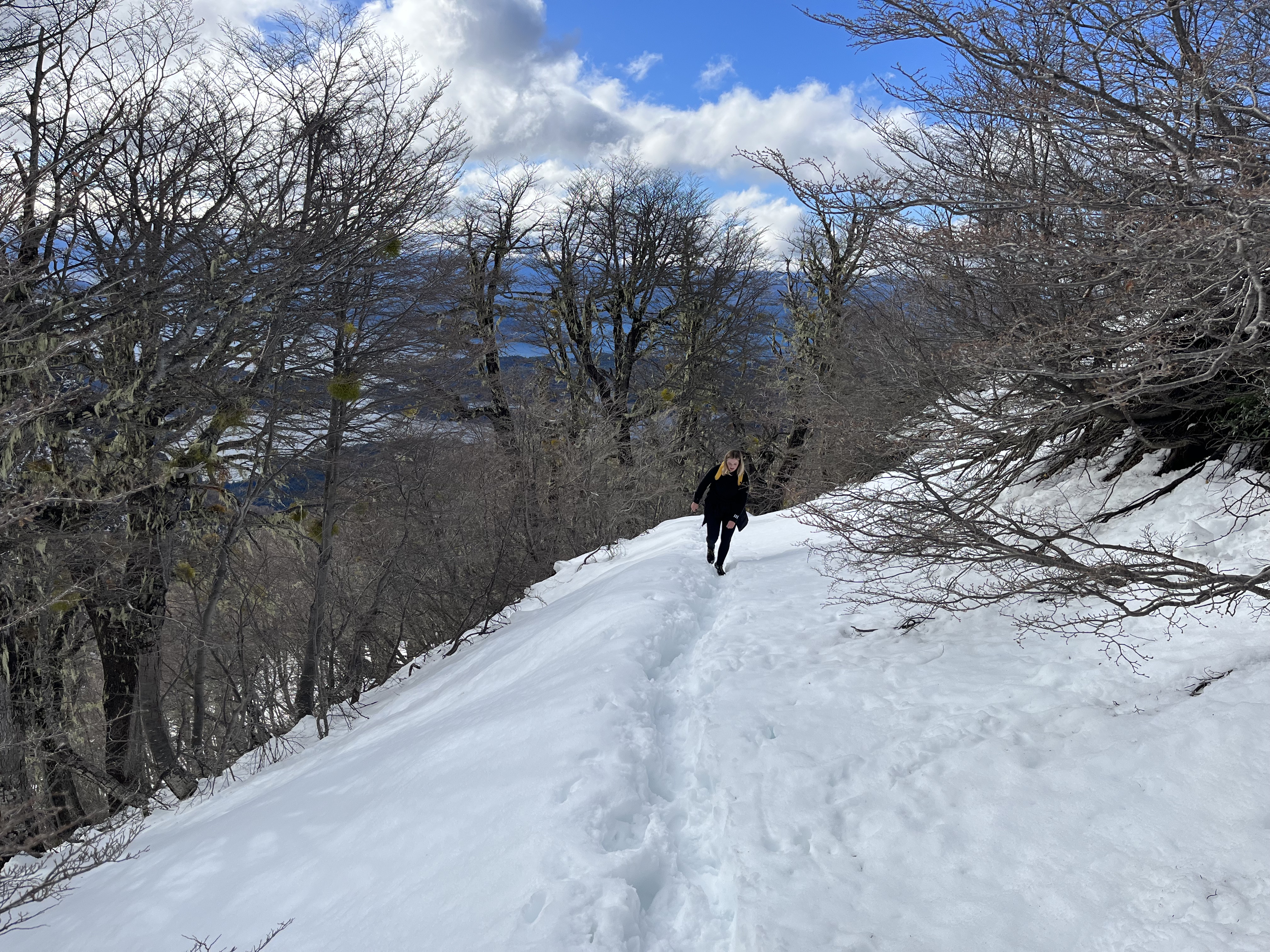
From halfway onward, the snow reached our knees at times. We didn’t have the proper footwear or equipment; the terrain even required snowshoes to walk properly. Still, we kept going. It took us about three and a half hours of constant ascent over six kilometers.
The last kilometer was the hardest: steeper slope, deeper snow, and slow progress that took nearly an hour.
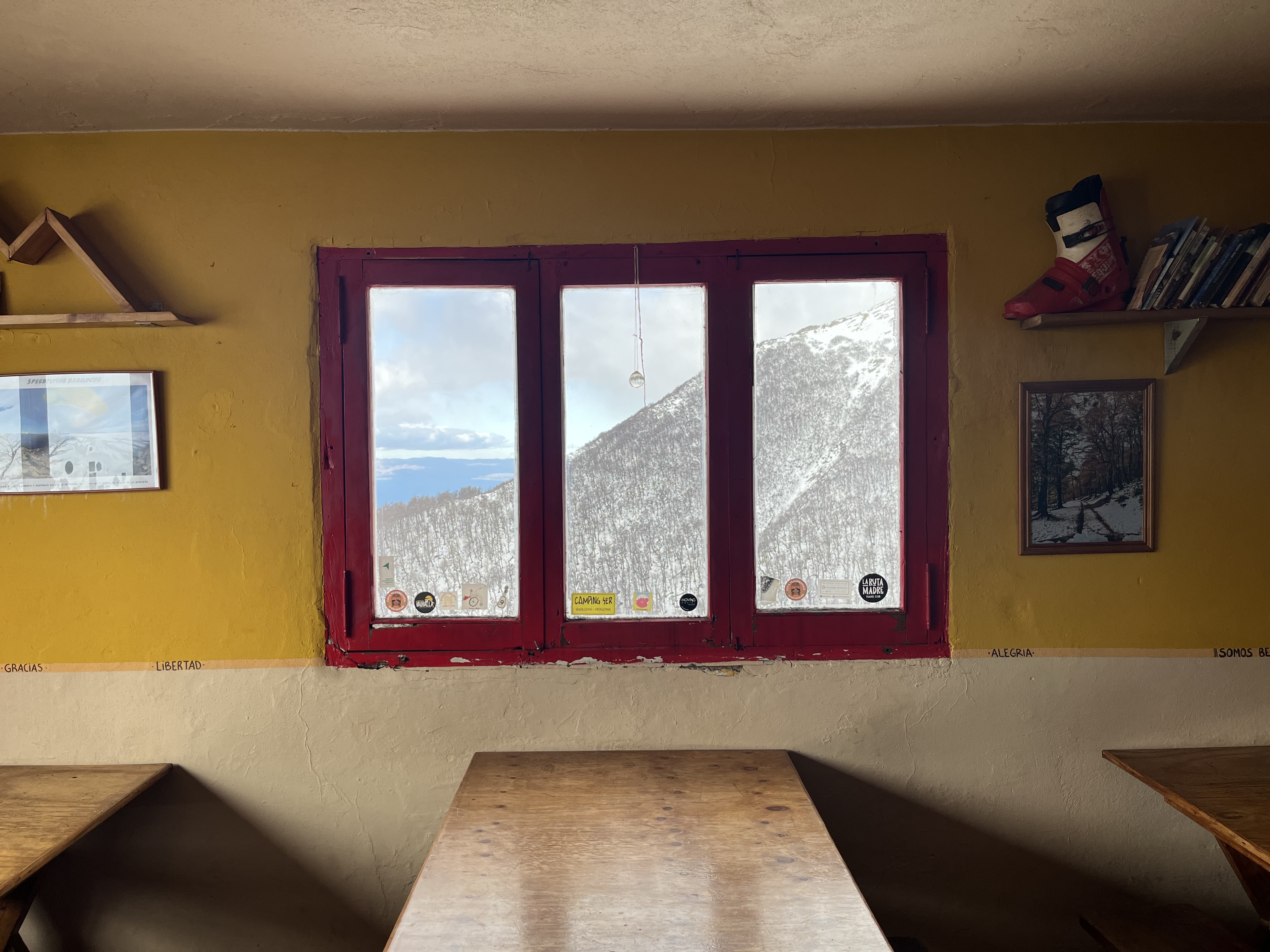
When we arrived, the refuge was closed due to the weather. A caretaker welcomed us and kindly invited us in for something warm. Inside, there was a couple from Uruguay who had gone through a similar experience shortly before.
You may also be interested in
- Cerro Campanario - Complete Guide
- Mirador Brazo Tristeza - Complete Guide
- Circuito Chico - Complete Guide
- Cerro Catedral - Complete Guide
- Villa Tacul - Complete Guide
- Llao Llao Viewpoint - Complete Guide
- Lake Gutierrez and Los Duendes Waterfall - Complete Guide
- What to do in Bariloche in 5 days - Complete Guide
- What to pack for Patagonia - Complete Guide
The trail starts at km 22.5 of Circuito Chico, next to Arroyo Lopez, on the paved road.
-
By car - Drive along Avenida Bustillo to the roundabout at km 18. Take Circuito Chico to the right and continue until the Arroyo Lopez sign (approx. km 22.5), where there is space to park.
-
Public transport - Take bus line 10 toward Colonia Suiza and get off at the trailhead stop.
The trail begins next to Arroyo Lopez, beside a kiosk/cabin visible from the road.
PUBLICIDAD
Travel with Data: Get your Saily eSIM
- ✓Internet in seconds upon landing
- ✓Flexible plans in 180+ countries
- ✓Easy setup directly via the App
The hike to the refuge is popular because it does not require technical skills, but it does require physical fitness:
-
Approximate distance: 6 km uphill from the start to the refuge.
-
Elevation gain: between 800 and 1,260 m of accumulated ascent.
-
Refuge altitude: 1,620 m above sea level.
-
Estimated duration: between 3 and 4 hours to ascend (depending on pace and breaks).
The trail is signposted and well marked, although markings can be sparse at the beginning.
-
Trek to Refugio Lopez: moderate difficulty in summer (constant incline and sometimes rocky terrain).
-
In winter / snow: much more difficult; requires experience, proper equipment (crampons, ice axes) and extreme caution.
The trail ends by crossing Arroyo Lopez, which can be challenging if water levels are high in spring or after heavy rain.
Refugio Lopez is a private mountain hut, one of the largest and most comfortable in Bariloche, with capacity for around 100 people and a large dining area.
-
Altitude: 1,620 m above sea level.
-
Services: dining room, rooms, bathrooms with running water (depending on season).
The refuge may close in winter. The trail usually remains open, but the refuge may not offer services during the coldest months.
Can you notify or book in advance?
It is recommended to contact the refuge directly to check availability and prices if you plan to stay overnight.
During high season (summer – spring) it usually fills up quickly, so booking in advance is recommended.
Once at the top, there are several additional excursions:
-
La Hoya – approximately 30 minutes further from the refuge. There is usually snow even in summer.
-
Pico Turista – about 1 hour from the refuge, with excellent panoramic views.
You can also continue toward Laguna Negra or connect with other refuges on longer multi-day routes.
-
Fire and campfires – It is not allowed to light fires in the National Park or along the trail.
-
Registration and safety – In some cases it is mandatory to complete a trekking registration before starting, especially if planning long routes.
-
Exposed sections and cliffs – There are areas with steep slopes and drop-offs, especially near the end.
-
Stream crossing – In the final meters before reaching the refuge, you must cross Arroyo Lopez, which can increase in flow during snowmelt season.
-
Always inform someone if you are going alone or in a group.
-
Water and gear – Bring at least 1.5–2 liters of water per person. Proper footwear, trekking poles, and sun protection are essential.
-
Weather and snow – Weather changes quickly in the mountains. Check the forecast before heading out. In winter, snow may cover much of the trail.
-
Spring to autumn (October – April): more stable conditions and the refuge is usually open.
-
Winter (May – September): more snow, higher difficulty, and possible refuge closure.
The idea of going to Refugio Lopez came out of nowhere. No plan, little information, and completely spontaneous, we decided to go on a very snowy winter day. We didn’t know that beyond a certain point the trail was covered in deep snow, nor that during those weeks the path was actually closed due to weather conditions.
From halfway onward, the snow reached our knees at times. We didn’t have the proper footwear or equipment; the terrain even required snowshoes to walk properly. Still, we kept going. It took us about three and a half hours of constant ascent over six kilometers.
The last kilometer was the hardest: steeper slope, deeper snow, and slow progress that took nearly an hour.
When we arrived, the refuge was closed due to the weather. A caretaker welcomed us and kindly invited us in for something warm. Inside, there was a couple from Uruguay who had gone through a similar experience shortly before.
PUBLICIDAD
- Cerro Campanario - Complete Guide
- Mirador Brazo Tristeza - Complete Guide
- Circuito Chico - Complete Guide
- Cerro Catedral - Complete Guide
- Villa Tacul - Complete Guide
- Llao Llao Viewpoint - Complete Guide
- Lake Gutierrez and Los Duendes Waterfall - Complete Guide
- What to do in Bariloche in 5 days - Complete Guide
- What to pack for Patagonia - Complete Guide
Galery
PUBLICIDAD
Get Your International Travel Insurance Quote
- ✓International medical insurance
- ✓24/7 immediate assistance in your language
- ✓Ideal for trekking & adventure


Preferences
Language
Color
Text
Width